
- Home >
- Stock Videos >
- Rotating 3D North America Globe Revealing Rocky Mountains and Topographic Terrain Vertical Video
Rotating 3D North America Globe Revealing Rocky Mountains and Topographic Terrain Vertical Video Video
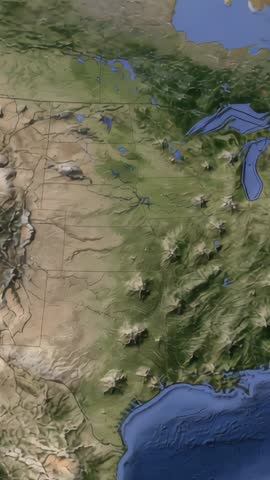
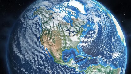
AI Generated Image. Vertical 3D map animation rotating eastward over North America, revealing Rocky Mountains, Great Lakes, Gulf of Mexico, and varied terrain elevation. Serving as cinematic opener for geography lectures, science documentaries, and travel promotions. Providing dynamic background for social media reels, vertical ads, and mobile-first storytelling. Helping illustrate elevation gradients, watershed flows, and mountain chain orientation for classroom demonstrations and corporate presentations. Allowing overlay of animated markers, labels, and flight paths for narrated tours, infographic sequences, and explainer videos. Delivering strong topographic shading and clear elevation contrast for museum exhibits, news packages, and educational apps. Recommending usage for intro segments in geography lessons, background for travel or outdoor adventure promos, visual aid for environmental reports, and vertical creative for social platforms. Adapting easily to color grading, voiceover, lower-third overlays, and branding elements.
Powered by 


0
downloads
downloads
Tags:
More
Credit Photo
If you would like to credit the Photo, here are some ways you can do so
Text Link
video Link
<span class="text-link">
<span>
<a target="_blank" href=https://pikwizard.com/video/rotating-3d-north-america-globe-revealing-rocky-mountains-and-topographic-terrain-vertical-video/35b8033097ee3cb108fe788ef9af8a1d/>PikWizard</a>
</span>
</span>
<span class="image-link">
<span
style="margin: 0 0 20px 0; display: inline-block; vertical-align: middle; width: 100%;"
>
<a
target="_blank"
href="https://pikwizard.com/video/rotating-3d-north-america-globe-revealing-rocky-mountains-and-topographic-terrain-vertical-video/35b8033097ee3cb108fe788ef9af8a1d/"
style="text-decoration: none; font-size: 10px; margin: 0;"
>
<video controls style="width: 100%; margin: 0;">
<source src="" type="video/mp4"
poster="https://pikwizard.com/pw/medium/35b8033097ee3cb108fe788ef9af8a1d.jpg"/>
Your browser does not support the video tag.
</video>
<p style="font-size: 12px; margin: 0;">PikWizard</p>
</a>
</span>
</span>
Free (free of charge)
Free for personal and commercial use.
Author: AI Creator