
- Home >
- Stock Videos >
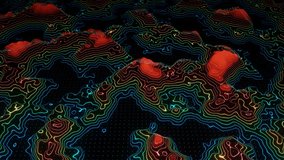
- Vertical Panning 3D Relief Map From US to Arctic Showing Topography, Borders and Great Lakes Ice
Vertical Panning 3D Relief Map From US to Arctic Showing Topography, Borders and Great Lakes Ice Video
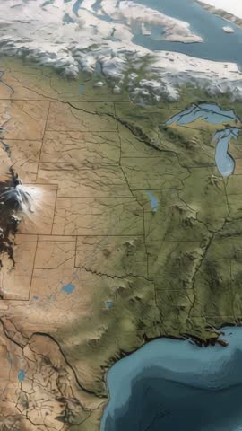
AI Generated Image. Showing vertical panning sequence of 3D relief map moving from continental US toward Arctic with visible Great Lakes and ice cap. Highlighting elevation changes, mountain ranges, river basins, and state borders for clear geographical context. Suited for educational videos explaining topography, climate impact, or glacial coverage; documentary openers; news graphics; and environmental presentations. Providing smooth vertical motion and pronounced terrain relief for use as background or main visual in broadcast, online content, social media, mobile apps, and interactive displays. Supporting overlays and annotations for marking routes, borders, data points, or climate trends during post production.
Powered by  - Get 15% off with code: PIKWIZARD15


0
downloads
downloads
Tags:
More
Credit Photo
If you would like to credit the Photo, here are some ways you can do so
Text Link
video Link
<span class="text-link">
<span>
<a target="_blank" href=https://pikwizard.com/video/vertical-panning-3d-relief-map-from-us-to-arctic-showing-topography-borders-and-great-lakes-ice/580d89a06f4bcc9631c73540599a41b4/>PikWizard</a>
</span>
</span>
<span class="image-link">
<span
style="margin: 0 0 20px 0; display: inline-block; vertical-align: middle; width: 100%;"
>
<a
target="_blank"
href="https://pikwizard.com/video/vertical-panning-3d-relief-map-from-us-to-arctic-showing-topography-borders-and-great-lakes-ice/580d89a06f4bcc9631c73540599a41b4/"
style="text-decoration: none; font-size: 10px; margin: 0;"
>
<video controls style="width: 100%; margin: 0;">
<source src="" type="video/mp4"
poster="https://pikwizard.com/pw/medium/580d89a06f4bcc9631c73540599a41b4.jpg"/>
Your browser does not support the video tag.
</video>
<p style="font-size: 12px; margin: 0;">PikWizard</p>
</a>
</span>
</span>
Free (free of charge)
Free for personal and commercial use.
Author: AI Creator