
- Home >
- Stock Photos >
- 3D Sphere Geospatial Mapping on Desert Landscape
3D Sphere Geospatial Mapping on Desert Landscape Image
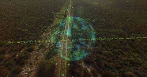
3D sphere with geospatial mapping engages over an arid desert terrain with multiple dirt tracks. Illuminated triangular facets and informational data indicators showcasing applications in advanced technology fields. Perfect for presentations about land analysis, technological advancements in landscaping, or simulations in geographic studies.

downloads
Tags:
More
Credit Photo
If you would like to credit the Photo, here are some ways you can do so
Text Link
photo Link
<span class="text-link">
<span>
<a target="_blank" href=https://pikwizard.com/photo/3d-sphere-geospatial-mapping-on-desert-landscape/92da5f2e82a9a053e5e4a2eb3655b03c/>PikWizard</a>
</span>
</span>
<span class="image-link">
<span
style="margin: 0 0 20px 0; display: inline-block; vertical-align: middle; width: 100%;"
>
<a
target="_blank"
href="https://pikwizard.com/photo/3d-sphere-geospatial-mapping-on-desert-landscape/92da5f2e82a9a053e5e4a2eb3655b03c/"
style="text-decoration: none; font-size: 10px; margin: 0;"
>
<img src="https://pikwizard.com/pw/medium/92da5f2e82a9a053e5e4a2eb3655b03c.jpg" style="margin: 0; width: 100%;" alt="" />
<p style="font-size: 12px; margin: 0;">PikWizard</p>
</a>
</span>
</span>
Free (free of charge)
Free for personal and commercial use.
Author: People Creations