
- Home >
- Stock Photos >
- Aerial Highway Interchange with Digital Data Visualization Overlay
Aerial Highway Interchange with Digital Data Visualization Overlay Image

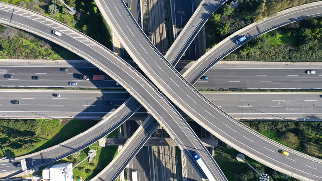
The scene captures an aerial view of a complex highway interchange running through a city with a blend of natural areas and urban infrastructure. The prominently featured digital overlays suggest data connectivity, infrastructure planning, and smart city technology. This composition illustrates the integration of advanced data systems in urban traffic management and planning. Ideal for projects focusing on urban mobility solutions, technological innovations in transportation, and modern city infrastructure challenges.
Powered by 


downloads
Tags:
More
Credit Photo
If you would like to credit the Photo, here are some ways you can do so
Text Link
photo Link
<span class="text-link">
<span>
<a target="_blank" href=https://pikwizard.com/photo/aerial-highway-interchange-with-digital-data-visualization-overlay/1e2e8334fe590ee76e8ca8cacd470cf5/>PikWizard</a>
</span>
</span>
<span class="image-link">
<span
style="margin: 0 0 20px 0; display: inline-block; vertical-align: middle; width: 100%;"
>
<a
target="_blank"
href="https://pikwizard.com/photo/aerial-highway-interchange-with-digital-data-visualization-overlay/1e2e8334fe590ee76e8ca8cacd470cf5/"
style="text-decoration: none; font-size: 10px; margin: 0;"
>
<img src="https://pikwizard.com/pw/medium/1e2e8334fe590ee76e8ca8cacd470cf5.jpg" style="margin: 0; width: 100%;" alt="" />
<p style="font-size: 12px; margin: 0;">PikWizard</p>
</a>
</span>
</span>
Free (free of charge)
Free for personal and commercial use.
Author: Authentic Images