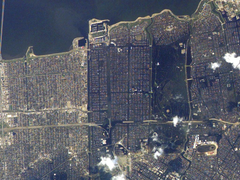
Flooded New Orleans Neighborhoods After Hurricane Katrina, ISS Aerial View Image

Aerial image taken on September 8, 2005, from the International Space Station, showing extensive flooding in New Orleans neighborhoods after Hurricane Katrina. I-610 and 17th Street Canal are visible. Greenish-brown coloration indicates standing water. Useful for discussions on natural disasters, urban flooding, and hurricane impact. Suitable for educational purposes, environmental studies, disaster recovery planning, and historical documentation.
downloads
Credit Photo
If you would like to credit the Photo, here are some ways you can do so
CC0 (Creative Commons Zero)
Free for personal and commercial use.


