
- Home >
- Stock Photos >
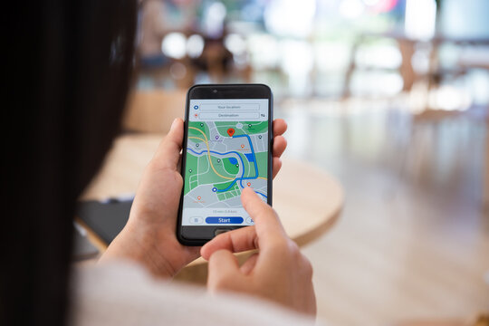
- Hand Using Smartphone for Navigation on Digital Grid Map
Hand Using Smartphone for Navigation on Digital Grid Map Image

Visualizing GPS navigation through a smartphone, this image illustrates real-time route mapping. Ideal for use in articles about GPS technology, mobile applications, travel guides, or technological advancements in navigation systems. It effectively conveys modern technological tools for direction finding and distance trekking.
Powered by 


downloads
Credit Photo
If you would like to credit the Photo, here are some ways you can do so
Text Link
photo Link
<span class="text-link">
<span>
<a target="_blank" href=https://pikwizard.com/photo/hand-using-smartphone-for-navigation-on-digital-grid-map/e9a00c5155f397aff76f8e3a64a4abec/>PikWizard</a>
</span>
</span>
<span class="image-link">
<span
style="margin: 0 0 20px 0; display: inline-block; vertical-align: middle; width: 100%;"
>
<a
target="_blank"
href="https://pikwizard.com/photo/hand-using-smartphone-for-navigation-on-digital-grid-map/e9a00c5155f397aff76f8e3a64a4abec/"
style="text-decoration: none; font-size: 10px; margin: 0;"
>
<img src="https://pikwizard.com/pw/medium/e9a00c5155f397aff76f8e3a64a4abec.jpg" style="margin: 0; width: 100%;" alt="" />
<p style="font-size: 12px; margin: 0;">PikWizard</p>
</a>
</span>
</span>
Free (free of charge)
Free for personal and commercial use.
Author: Creative Art
Similar Free Stock Images

Premium


Premium

Premium


Premium


Premium


Premium


Premium


Premium

Premium

Premium

Premium


Premium


AI


Premium

Premium


Premium


Premium


Premium


Premium

Premium


Premium


Premium

Premium


Premium


Premium

Premium

Explore More Free Stock Images