1. Home > 
  2. Stock Photos > 
  3. Satellite View of Scotland's Winter Landscape from Space

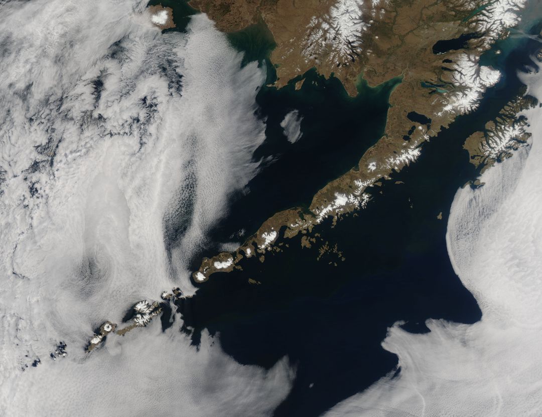
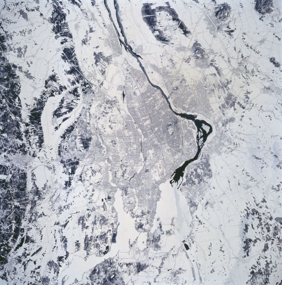
Satellite View of Scotland's Winter Landscape from Space Image

Satellite View of Scotland's Winter Landscape from Space

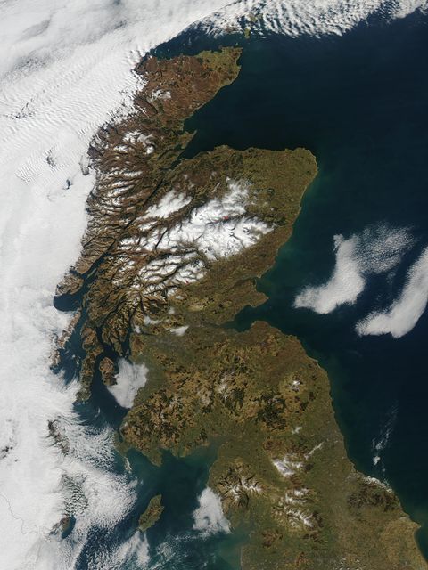
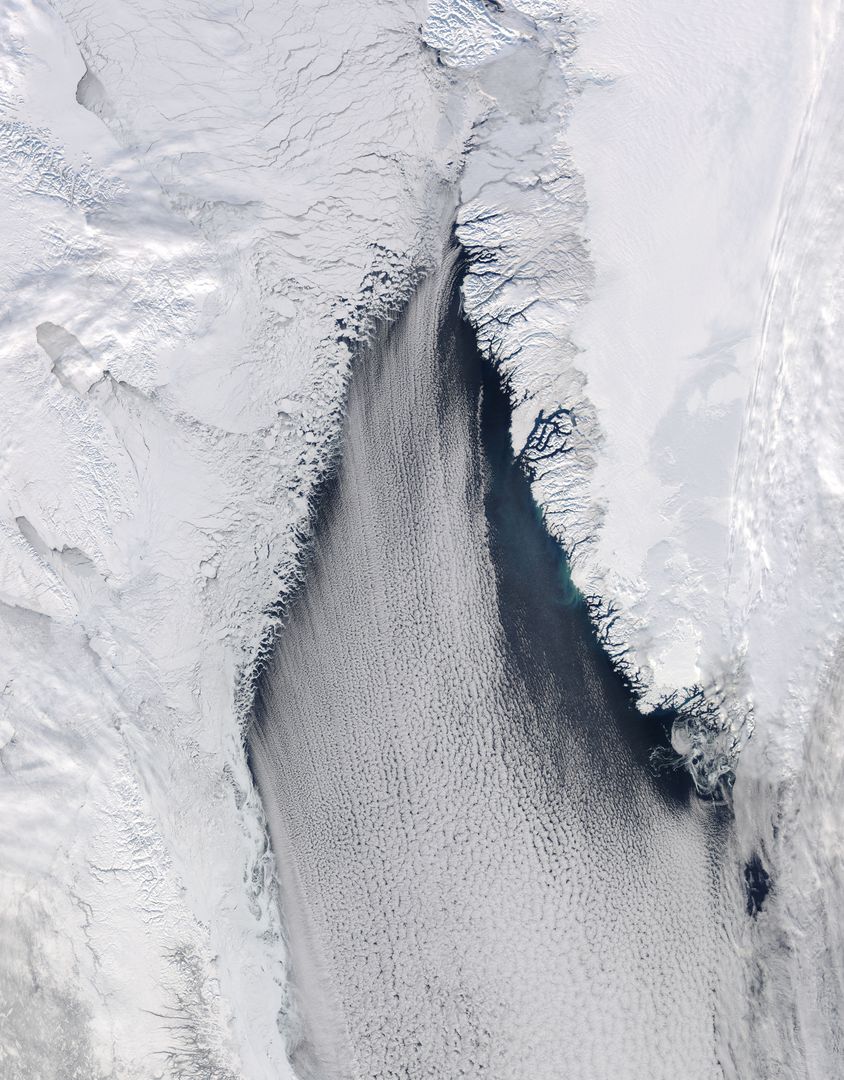
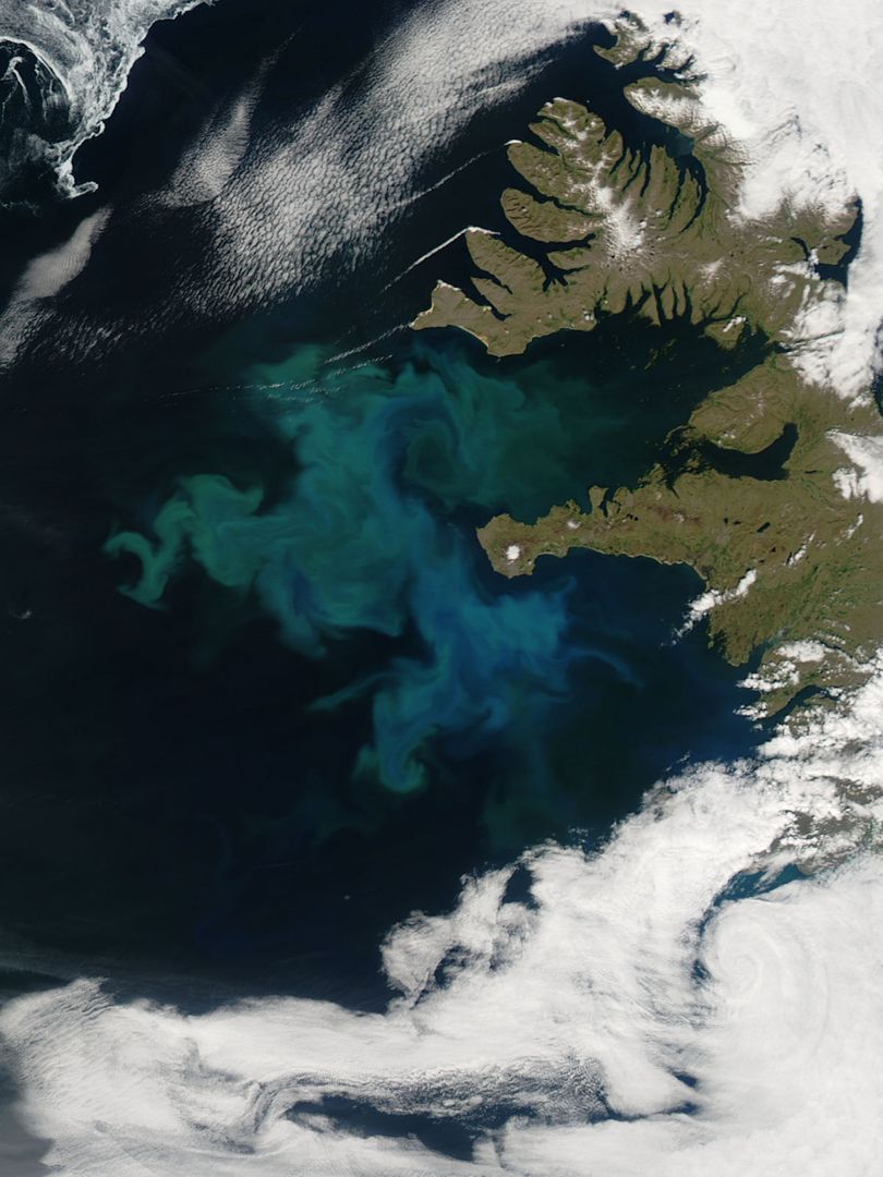
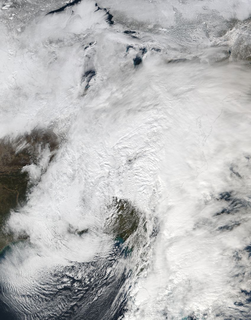
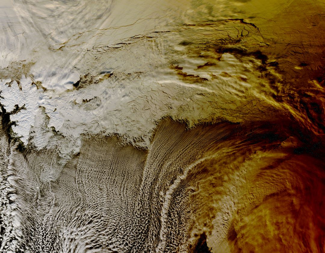
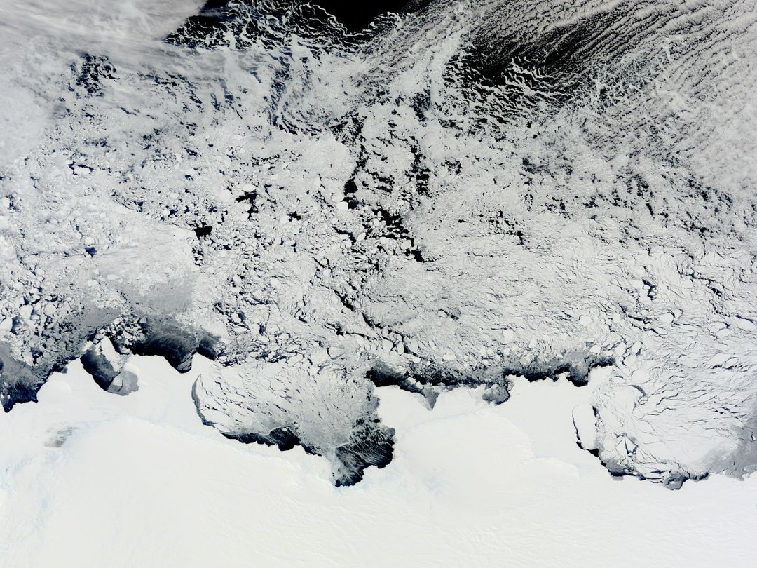
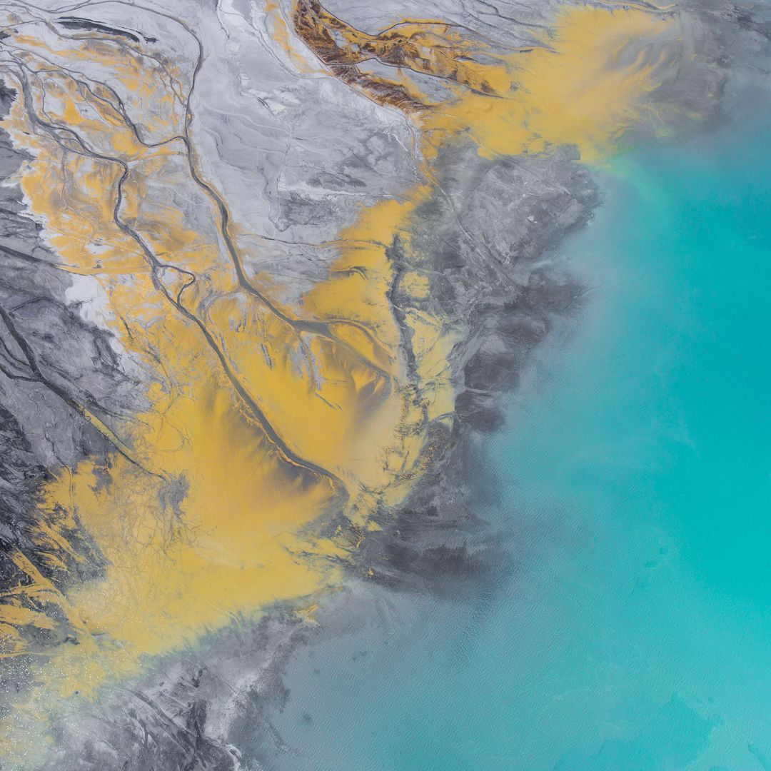
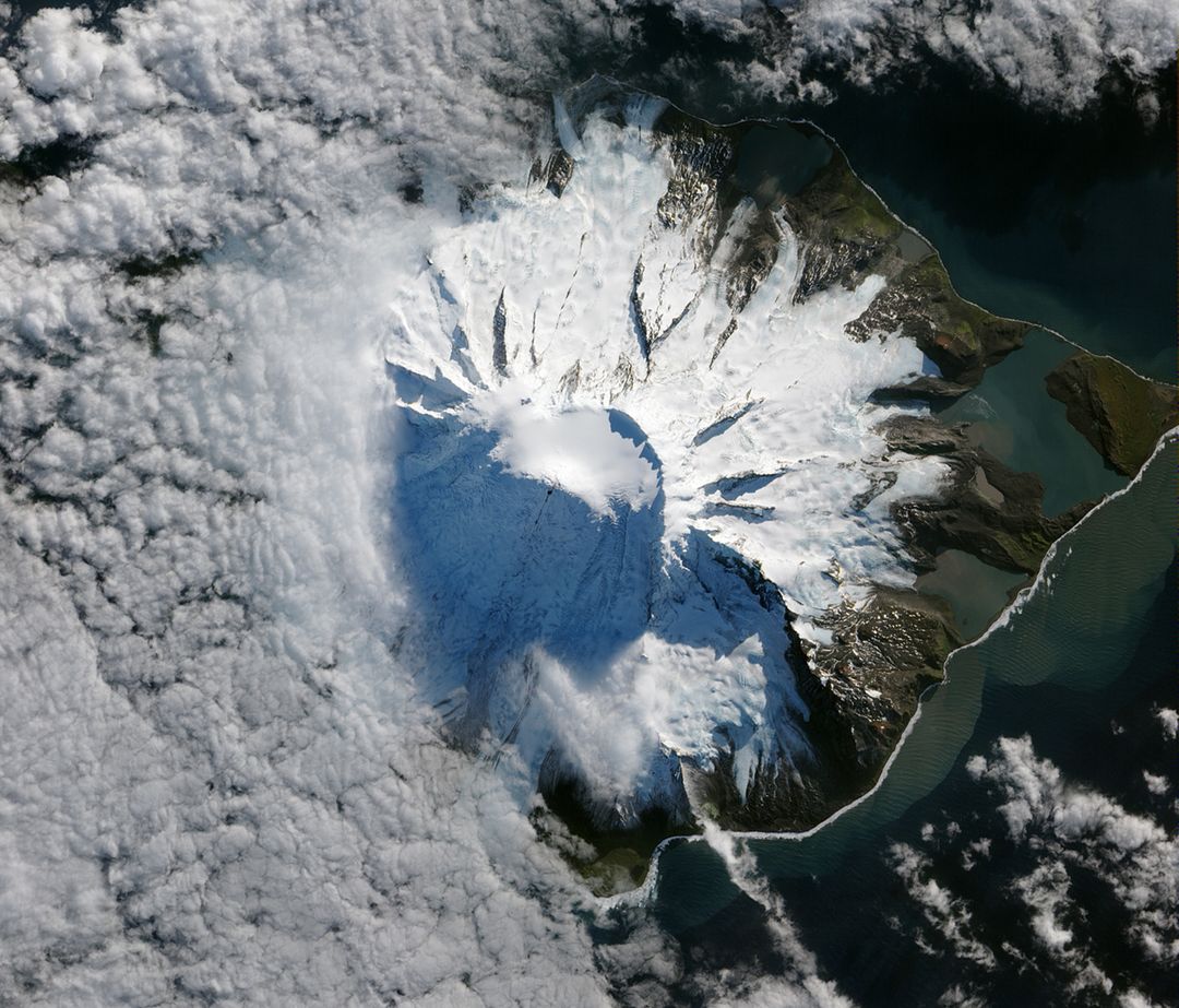
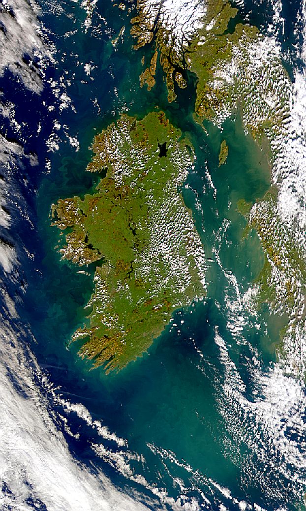
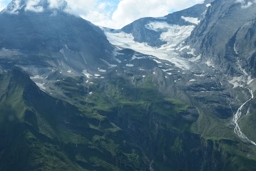
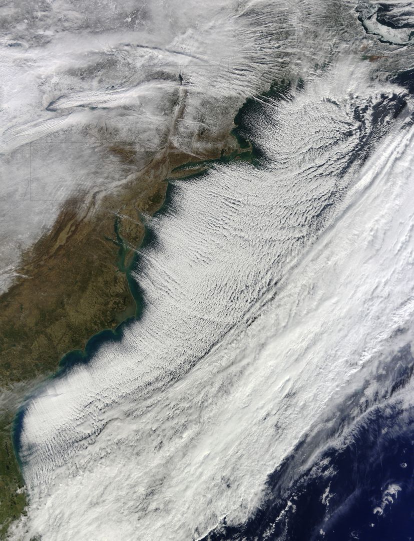
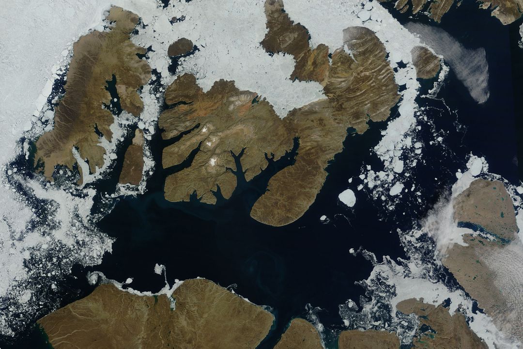
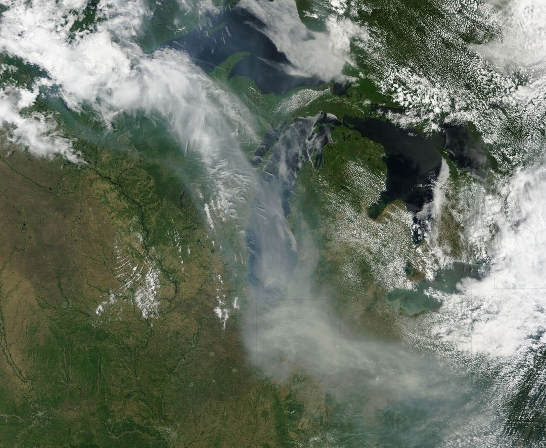
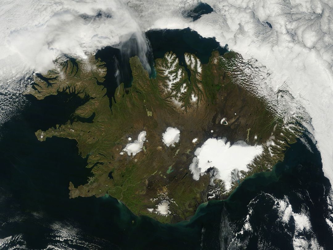
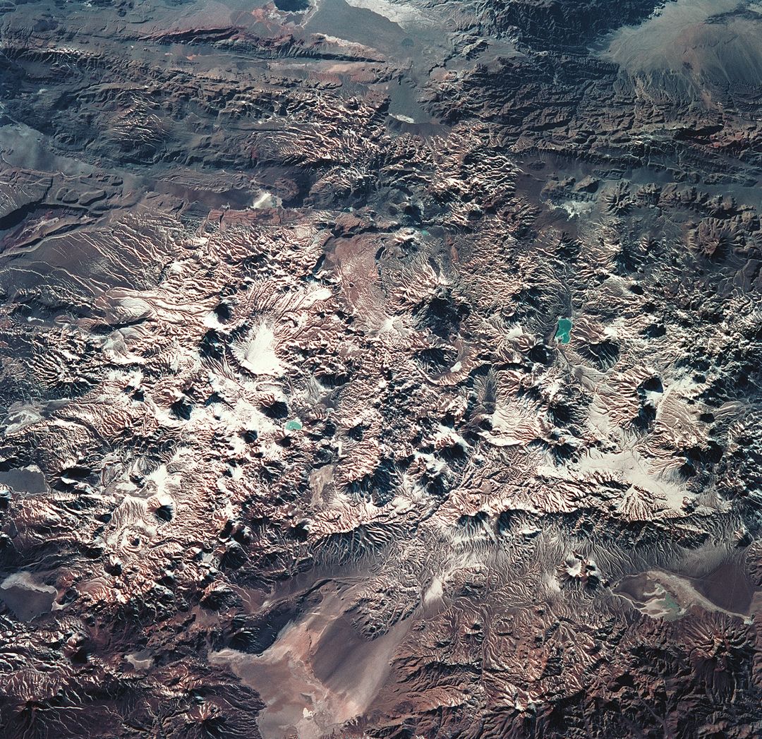
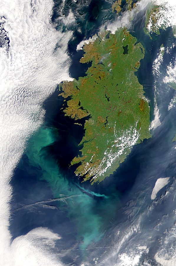
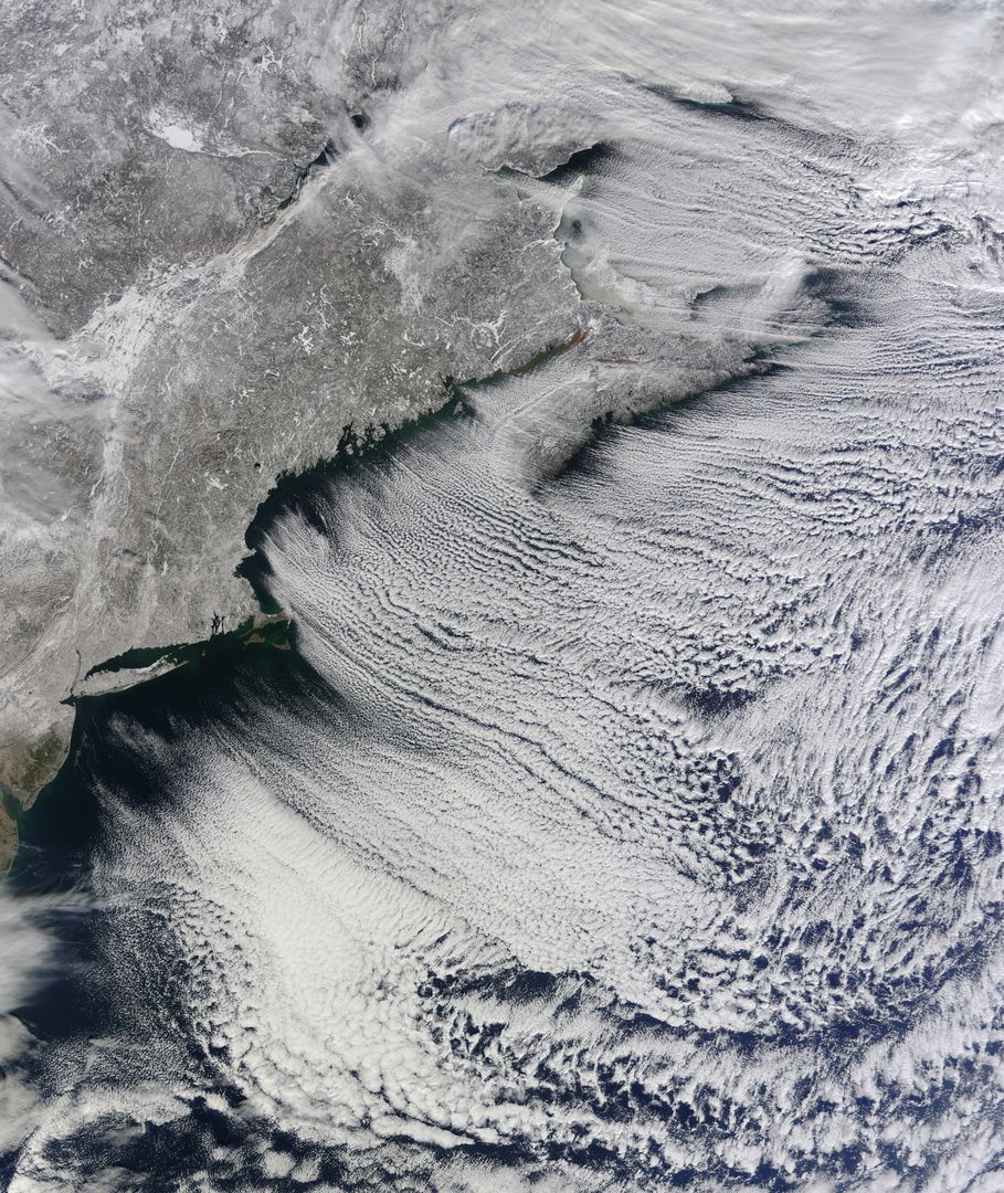
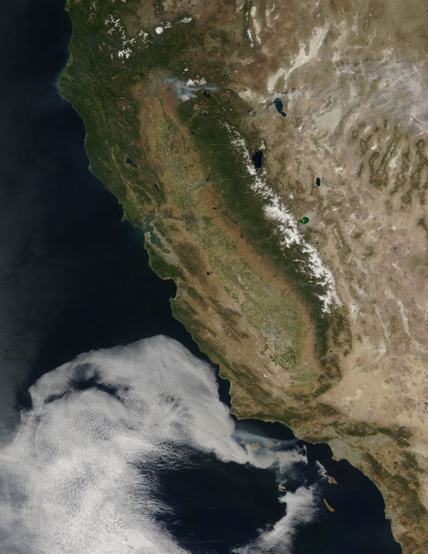
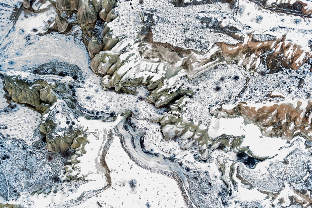
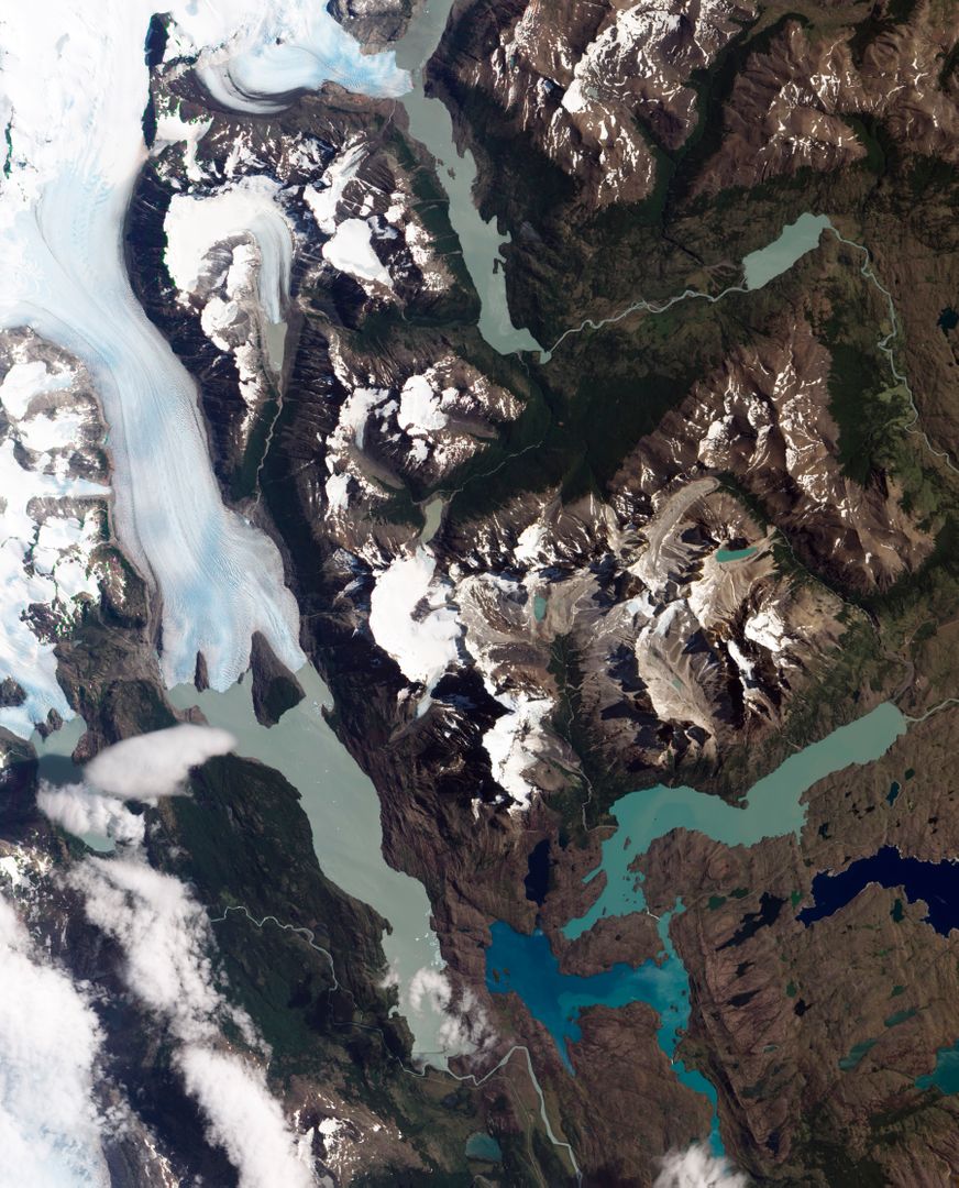
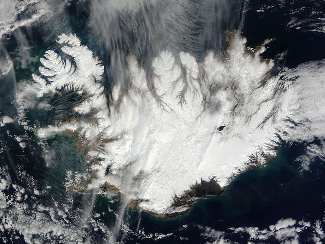
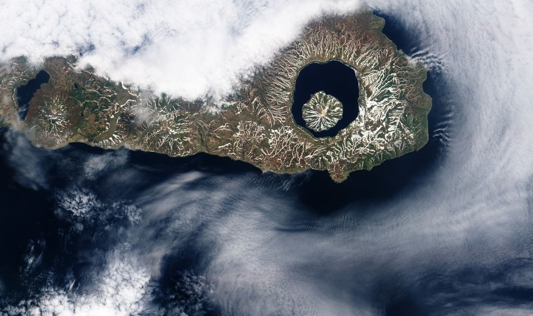
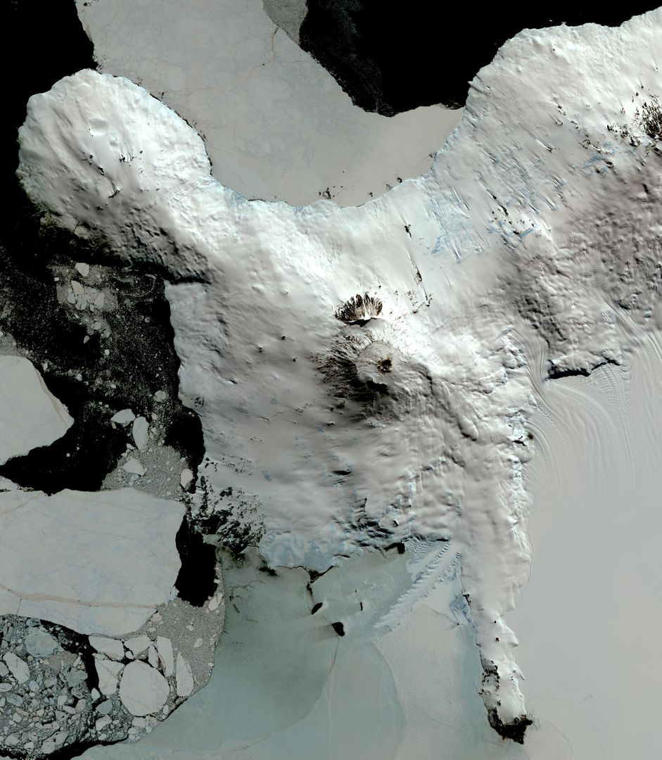
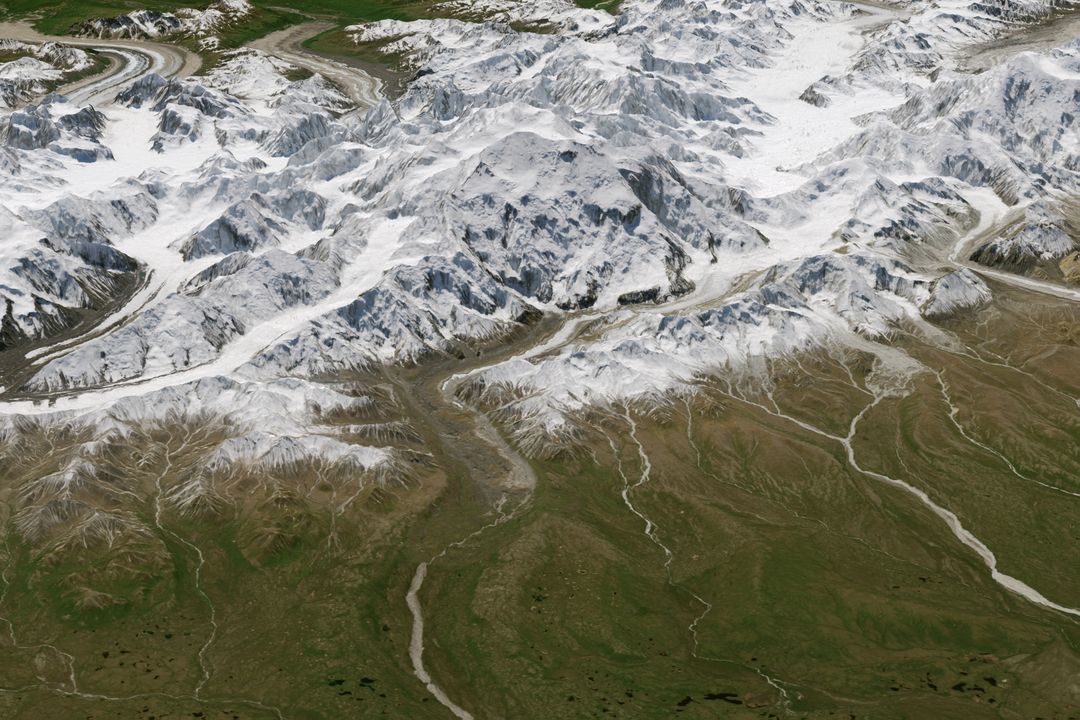
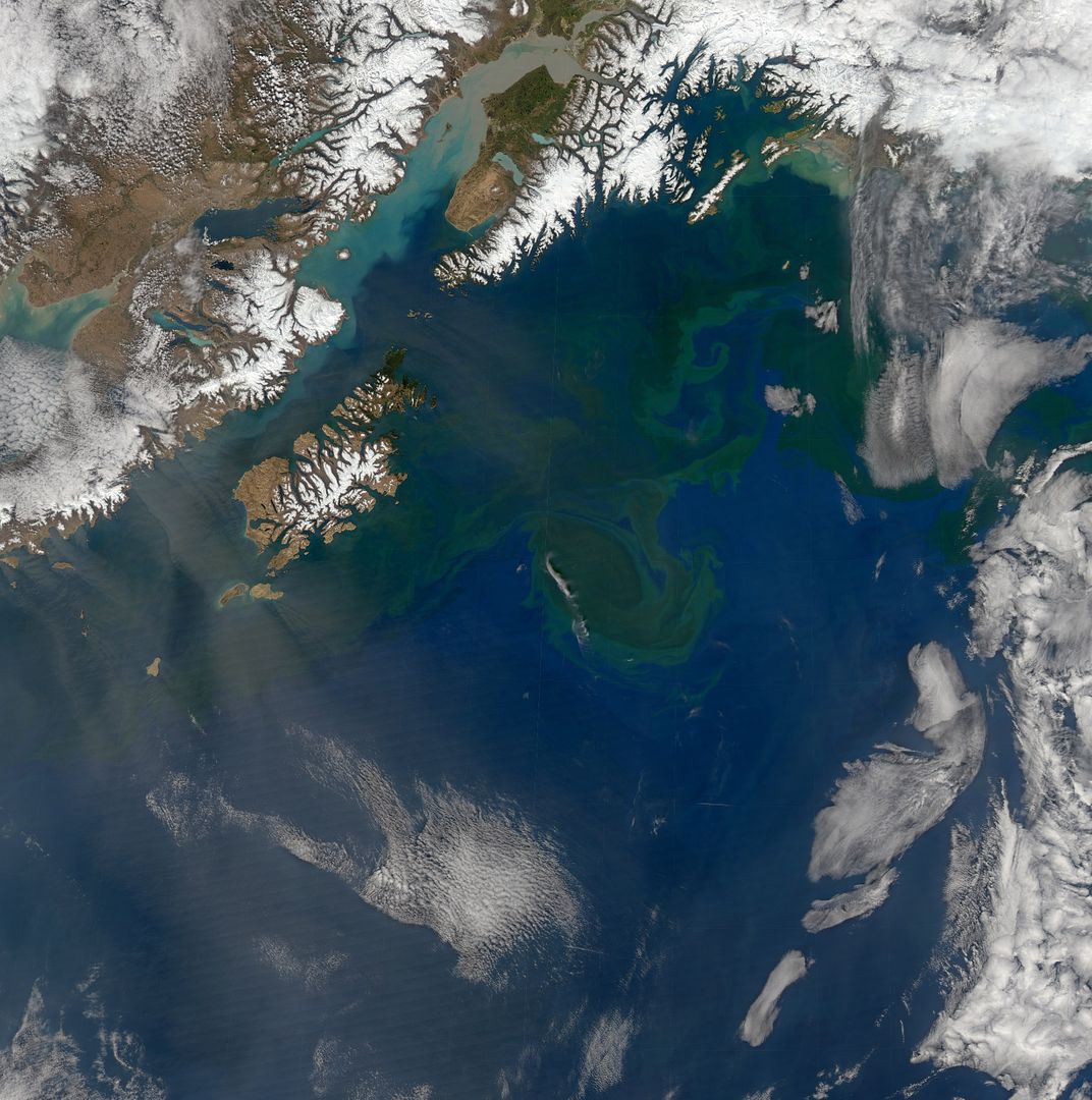
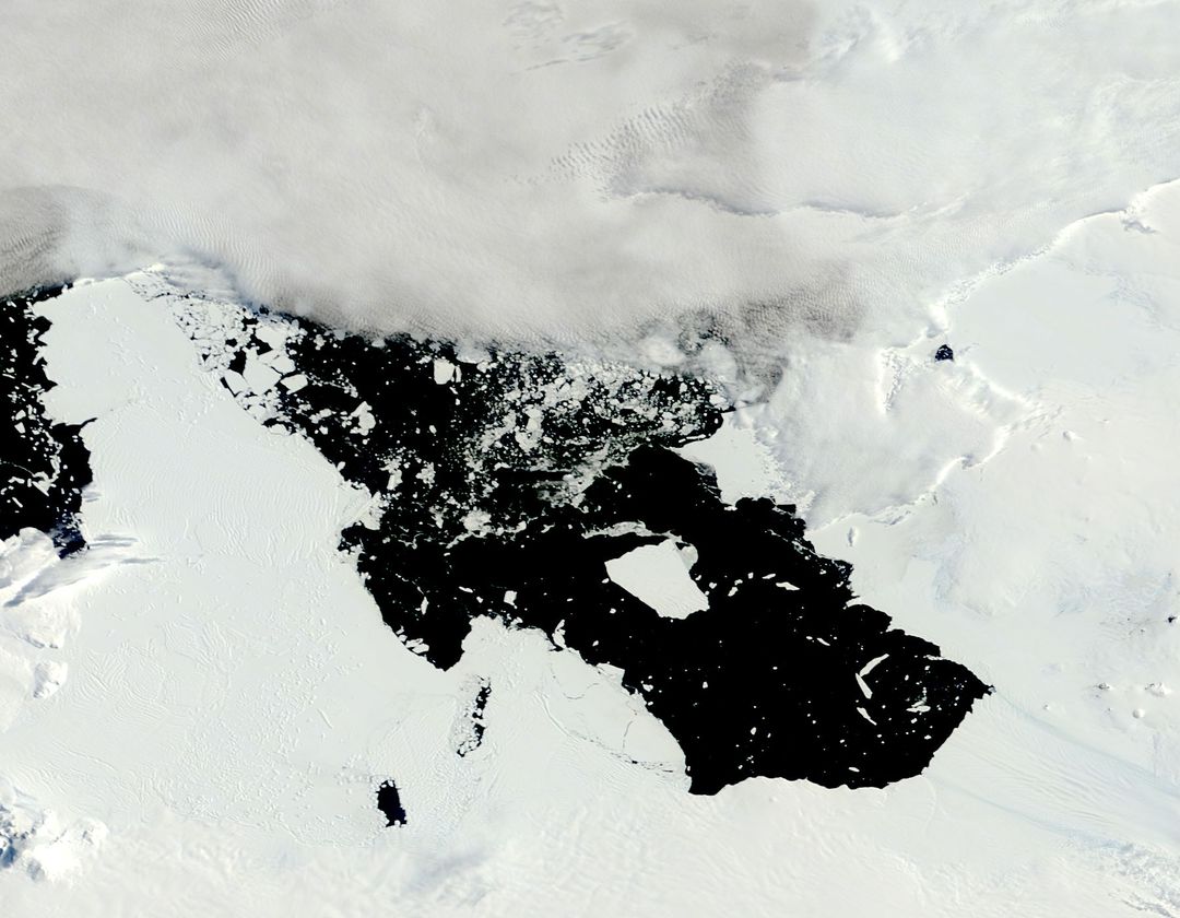
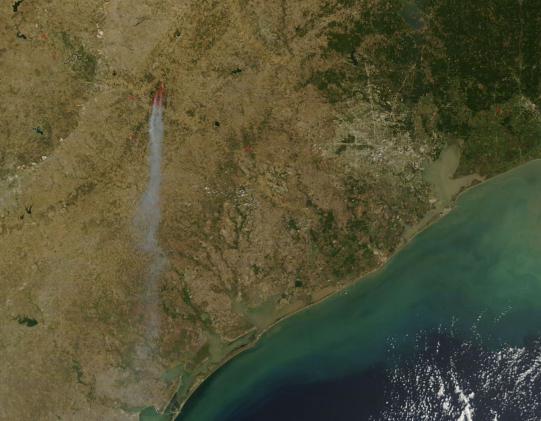
This stunning image captured by the Aqua satellite offers a rare, cloud-free view of Scotland's geographical diversity during late winter. Snow capped peaks of the Grampian Mountains and Northern Highlands are distinctly visible. The striking boundary between the Great Glen Fault, and bustling sediment in the Solway Firth estuary paint a picture of geological activity. Perfect for educational materials, geographical presentations, and apps focusing on Earth's observation and satellite data analysis.

Credit Photo

If you would like to credit the Photo, here are some ways you can do so

CC0 (Creative Commons Zero)

Free for personal and commercial use.

Similar Free Stock Images

Swirling Sea Ice Along Greenland's Coast Captured by NASA's Aqua Satellite
Spectacular Aerial View of Florida Keys Captured by NASA's Aqua Satellite
Clear Lake Reflecting Forest and Mountains with Cloudy Sky
Boat Near Stalactitic Ice Formation in Clear Blue Glacial Waters
Aleutian Islands from Space Displaying Breathtaking Volcanic Chain and Surrounding Fog
Aerial View of Ship-Wave Shaped Clouds Near Crozet Islands
Dense Haze Shrouds Northern China Seen from Space in December 2013
Majestic Mountain Landscape with Unique Cloud Formations
Aerial View of Snow-Covered Mountain Glacier with Ice Crevasses
Aerial View of Cloud Streets and Ice in Davis Strait, February 2013
Oblique View of Florida Peninsula, STS-95 Mission NASA
Satellite View of Tropical Storm Ana Near Carolinas Coast
Phytoplankton Bloom Off Newfoundland Coast Viewed from Space, August 2010
Phytoplankton Bloom Near Western Iceland Captured by Aqua Satellite
Hole-Punch and Canal Clouds over Coast with Supercooled Water Droplets
Satellite View of Tropical Storm Arthur with Cloud-Covered Eye
Aerial View of Vibrant Geothermal Area With Sulfuric Deposits
Suomi NPP Satellite View of Extensive Low Pressure Area Over Eastern USA
Satellite View of Vancouver and Fraser River from Landsat 5, 2011
Snow-Covered Northeastern United States from Space on Last Day of Meteorological Winter 2014
Breathtaking Mountainous Landscape with Flowing Waterfall and Snow-Capped Peaks
Aerial View of Snow-Covered Forest and Cabin
Solar Eclipse Shadow Over Arctic Ocean Captured by NASA Satellite
Aerial View of Knox, Law Dome, and Sabrina Coasts, Antarctica 2011
Aerial View of Turquoise Lake with Golden Sand Patterns and Rocky Terrain
Satellite View of Eruption on Mawson Peak, Heard Island
Winding Road Through Majestic Snow-Capped Mountains
Scenic Glacier Landscape with Mountain Range and Cloudy Sky
Satellite View of Ireland with Possible Coccolithophore Blooms
Breathtaking Alpine Mountain Landscape with Majestic Glacier
Aerial View of Snow-Capped Rugged Mountain Peaks in Misty Winter Landscape
Expansive Snowy Glacier under a Clear Blue Sky
Majestic Waterfall Cascading Down Rocky Mountain
MODIS Captures Cloud Streets Over Atlantic Ocean in 2014 Cold Snap
Satellite Image of Northeast Blizzard Aftermath January 28, 2015
Holiday Lights Brighten U.S. Cities Viewed from Space
Aerial View of United States East Coast with Jet Contrails, April 1968
Northwest Passage Sea Ice and Islands Captured by NASA’s Terra Satellite, August 2010
Sunlight Glint on Rivers in New York and Pennsylvania from Space, September 2007
Icy Glacial Landscape with Snow-Capped Mountains and Dark Rocky Terrain
Aerial View of Rough Sea Waves Crashing on Rocky Coastline
Majestic Snow-Covered Mountain Range with Glacial Landscape
Icy Winter Waterfall in Frozen Landscape
Drifting Wildfire Smoke Over Midwest Captured by Terra Satellite
Smoke from Wildfires over Hudson Bay as Seen from Space
Icelandic Landscape Captured from Space on Sunny August Day
Drone View of Serene Wetlands with Lush Vegetation and Calm Waters
Satellite View of Sea Ice Off Western Alaska in February 2014
NOAA GOES-East Satellite Image of Mid-Atlantic Showing Weather Before Moon Mission Launch
Aerial View of Serene Snow-Covered Mountain Peak
Majestic Mountain Range with Dense Forests and Serene Lake at Sunrise
Aerial View of Wintery Montreal Showing Rivers and Landmarks, 1994
Aerial View of Frozen Meltwater Lake Along Northeast Greenland Coast
Aerial View of Snow-Capped Mountain Range with White Clouds
Aerial View of Laguna Verde and Andes Mountains Captured from Space Shuttle Columbia
Fires in Northern Australia Captured by MODIS on Aqua Satellite
Satellite View of Northwest Passage in Canadian Arctic on August 31, 2015
Sea Ice and Melting Glaciers off the Greenland Coast, Captured by NASA Satellite
Tropical Cyclone Chapala Over Yemen Captured by NASA Aqua Satellite
Satellite View of Possible Coccolithophore Bloom South of Ireland, May 2000
Hurricane Dora Forming Over Eastern Pacific Ocean Viewed from Satellite
Meltwater Streams and Ponds at Columbia Glacier, Alaska in Summer 2008
Aerial View of Snow-Capped Mountains and River Valley in Winter
Scenic View of Snow-Covered Mountains with Geothermal Activity
Cloud Streets over North Atlantic Captured by NASA’s Terra Satellite
NASA Terra Satellite Captures Glory Phenomenon Over West Africa Coastline
Aerial View of River Flowing Through Landscape with Sparse Vegetation
Aerial View of Climbers Traversing Snowy Mountain Crevasse
Scenic View of the Andes Mountains and Turquoise Lakes
Satellite View of Sea Ice off Princess Astrid Coast, East Antarctica
California Coastal Regions from Space with Active Fire Area Outlined, May 2013
Scenic Mountain Reflection On Tranquil Lake
Aerial View of Snow-Covered Rocky Landscape
Aerial View of Grinding Glaciers in Torres del Paine National Park, Chile
Aerial View of Skiers on Snow-Capped Mountain Summit During Winter
Aerial View of Phytoplankton Bloom near St. Matthew Island, October 2014
Astronaut View of Iceland's Snow-Covered Terrain from Space
Pristine Snow-Capped Mountains Reflecting on Tranquil Lake Under Overcast Sky
Breathtaking Aerial View of Snow-Covered Mountain Range
Snow-Capped Mountains Reflecting on Tranquil Lake Under Cloudy Sky
Aerial View of Tao-Rusyr Caldera and Krenitzyn Peak on Onekotan Island
Satellite View of Santa Clara Area, Land and Coastal Regions, Nov 2015
Aerial View of Sequoia National Park, California Captured by Landsat 5 Satellite
Iceland Covered in Winter Snow Captured from Space
Aerial View of Mount Erebus, Antarctica's Active Volcano, Overlooking McMurdo Research Station
Aerial View of Denali Peaks with Snow and Green Valleys, Alaska
Satellite View of Turquoise Ocean Currents and Snowy Mountains
Massive Iceberg B-31 Calved from Pine Island Glacier, January 2014
NASA Satellite Image of Bastrop County Wildfires September 2011
Aerial View of Waves Crashing on Rocky Coastline
Aerial View of Snowcapped Mountains in Morocco
Aerial View of Snow-Capped Mountain Range with River Valley
Aerial View of Pyramid Lake, Nevada, USA – ISS Expedition 25, September 28, 2010
Hikers Exploring Rugged Glacier Landscape on Cloudy Day
Intense Wildfires in Boreal Forests of Eastern Siberia Captured by NASA Aqua Satellite
Colorful Phytoplankton Bloom in the Yellow Sea Captured by Aqua-MODIS on February 24, 2015
Aerial View of Snow-Covered Mountain Peaks in Winter
Satellite View of Lake Nasser in Egypt with Sunglint Highlighting Water
Aerial View of Heimdal Glacier in Greenland Captured by NASA
Aerial Coastal View with Breaking Waves and Clear Shoreline