1. Home > 
  2. Stock Photos > 
  3. Satellite View of Smoke and Haze from Fires in Sumatra, March 2014

Satellite View of Smoke and Haze from Fires in Sumatra, March 2014 Image

Satellite View of Smoke and Haze from Fires in Sumatra, March 2014

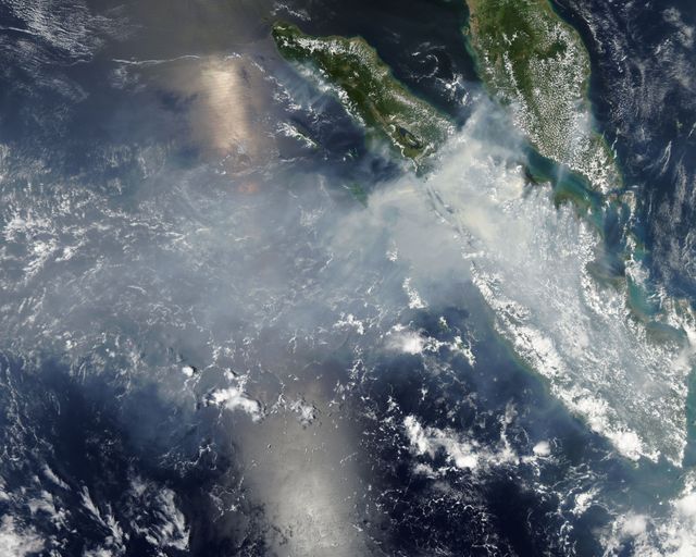
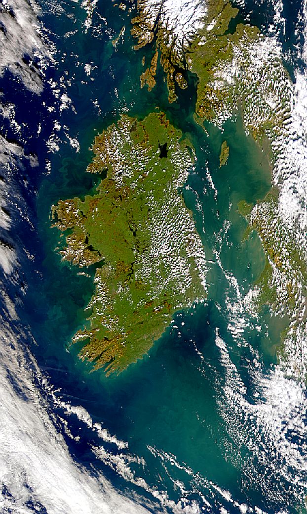
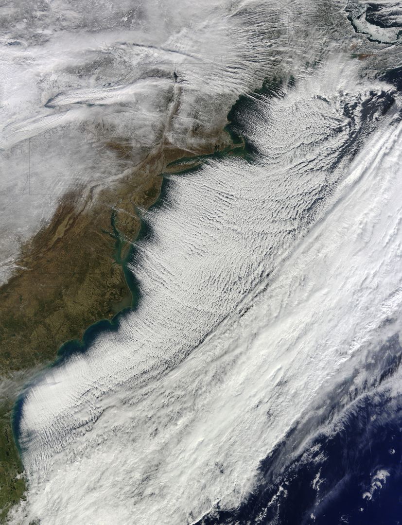
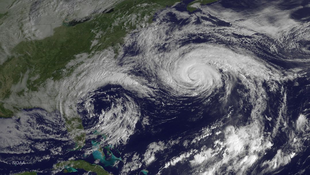
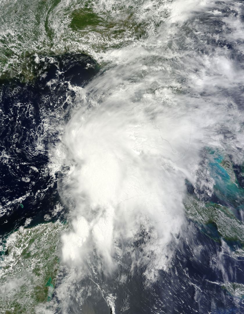
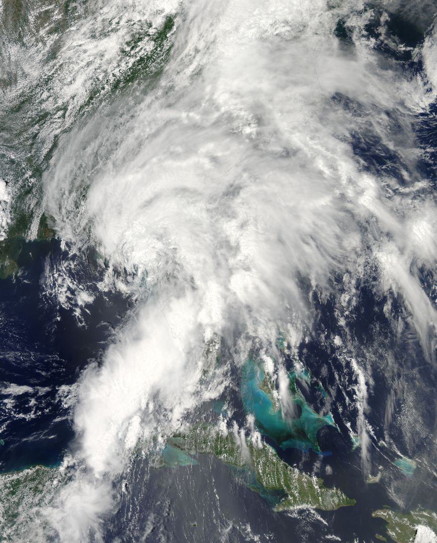
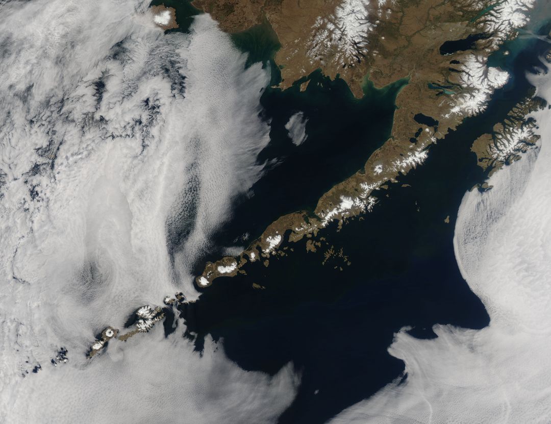
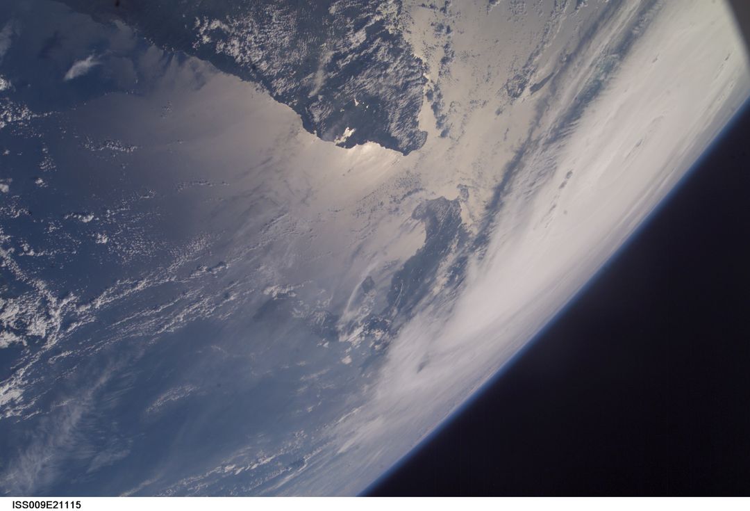
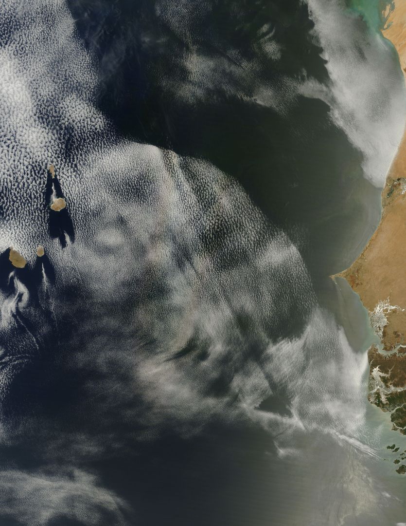
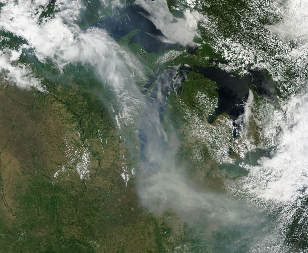
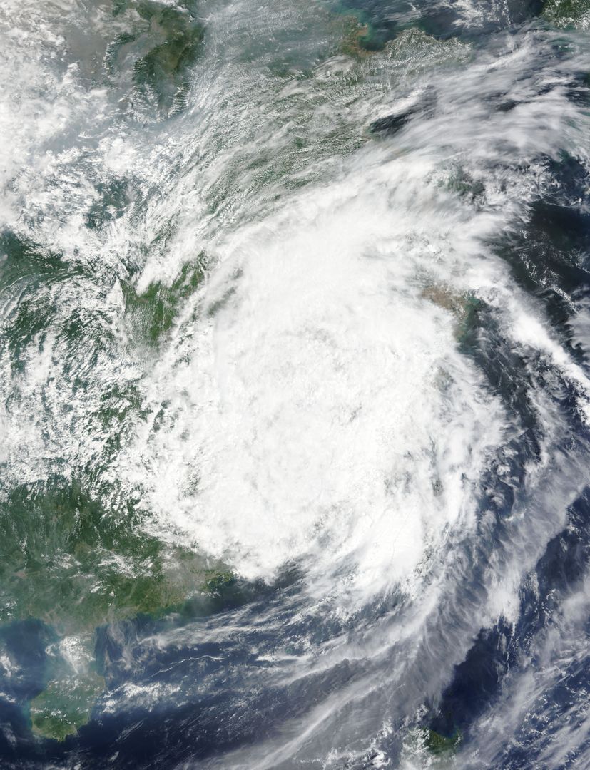
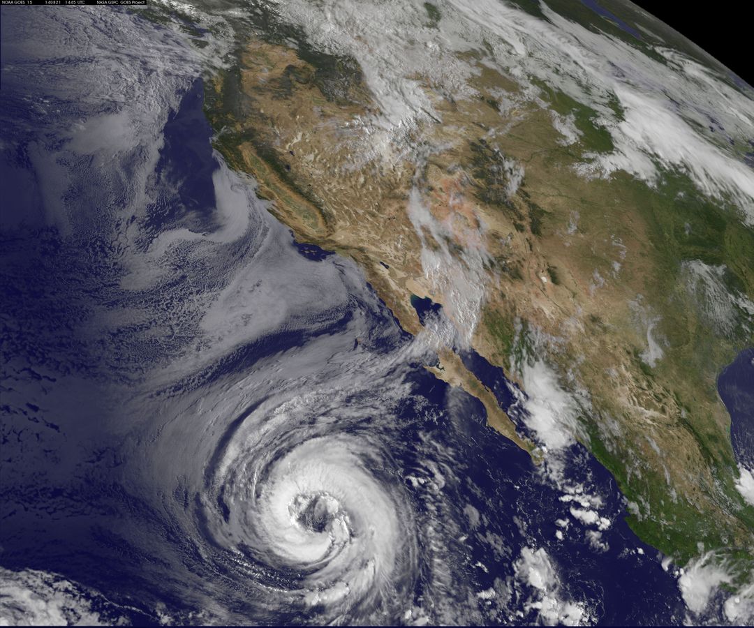
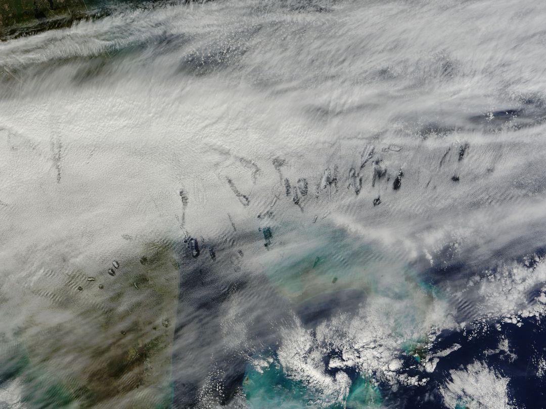
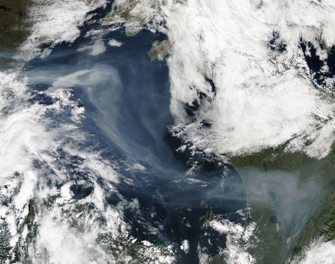
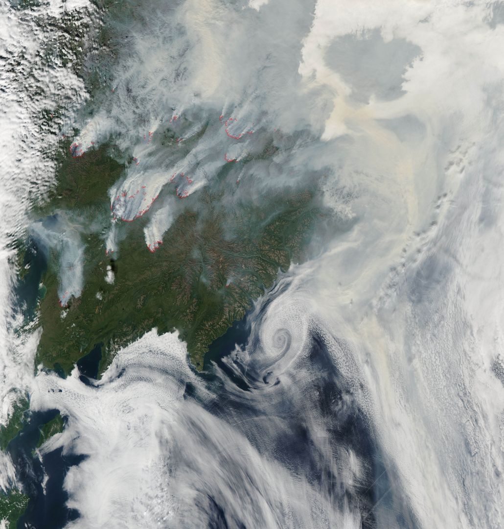
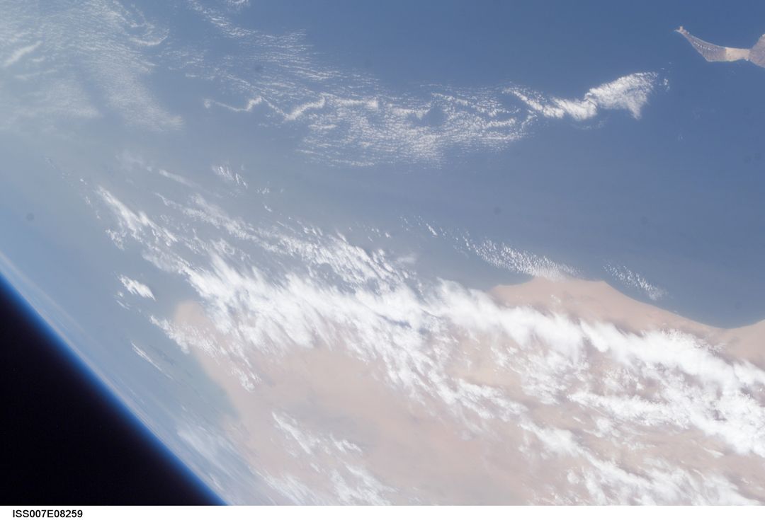
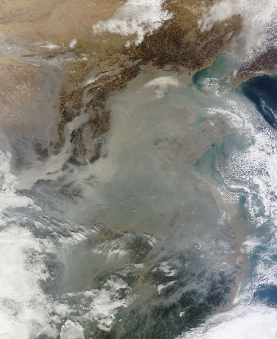
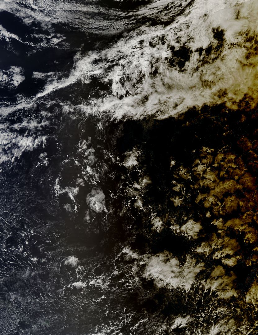
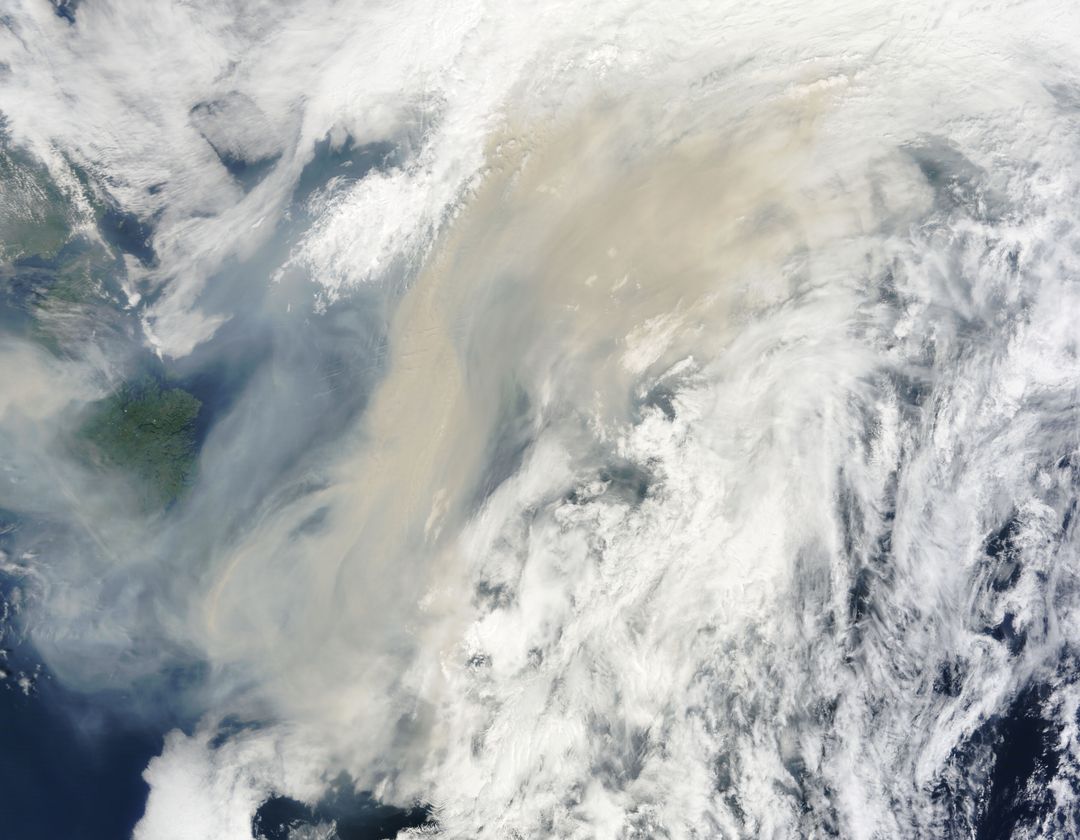
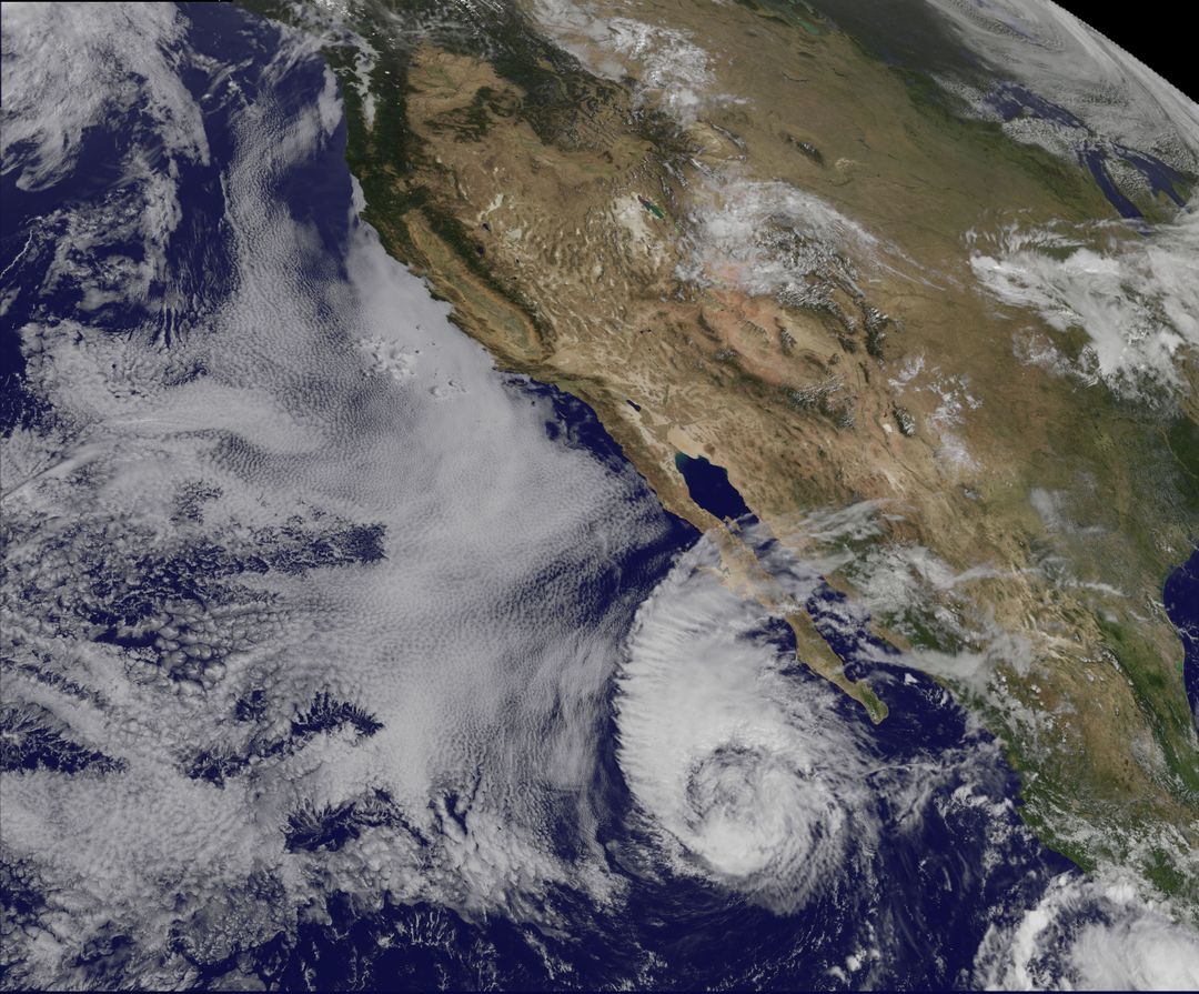
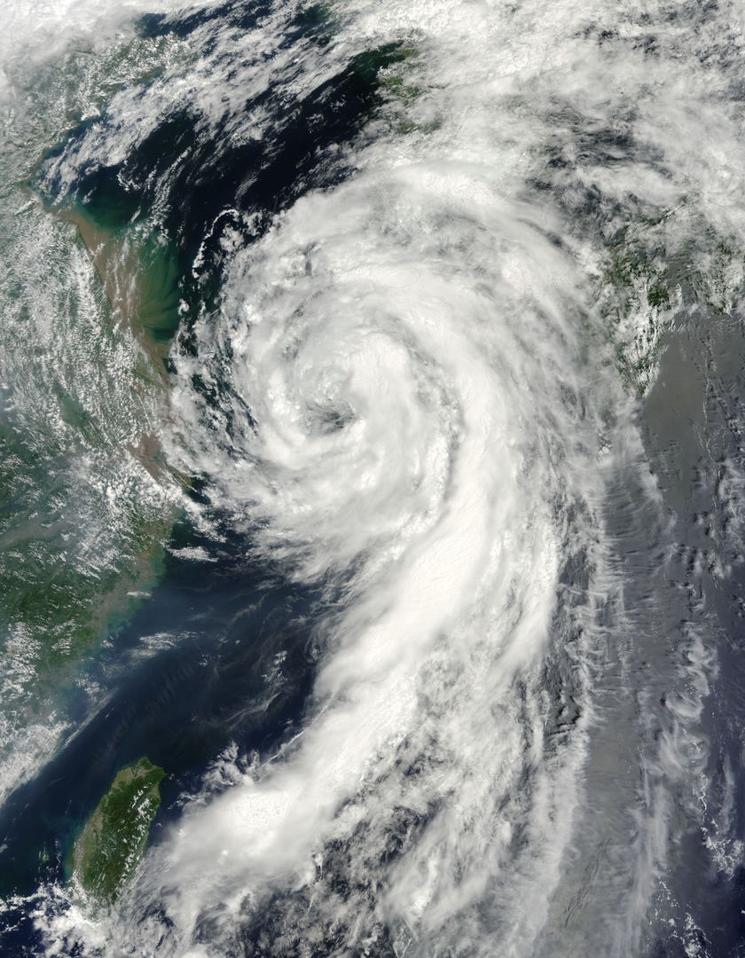
Heavy smoke and haze cover Sumatra, Indonesia, due to widespread fires designed for land clearing. Captured by NASA’s Aqua satellite on March 12, 2014, this true-color image highlights the severe environmental impact and visibly demonstrates poor air quality over the region. Thick bands obscure much of Riau region compelling school and flight cancelations and leading to hazardous living conditions. Useful for understanding pollution, environmental emergencies, land management, and the effects of illegal farming practices.

Powered by Shutterstock logo - Get 15% off with code: PIKWIZARD15
Scorched hillside under the tropical sun: dry season wildfires scar the landscape in rural Sumatra. - Powered by Shutterstock - Get 15% off with code: PIKWIZARD15Burning old rubber trees log. The cheapest way to clear the fields for new plantation which can cause haze at surrounding area. - Powered by Shutterstock - Get 15% off with code: PIKWIZARD15Burning old rubber trees log. The cheapest way to clear the fields for new plantation which can cause haze at surrounding area. - Powered by Shutterstock - Get 15% off with code: PIKWIZARD15Thick smoke rises from burning dry leaves and grass by the roadside, a quick method to clean ditches and road edges during dry weather in tropical Indonesia - Powered by Shutterstock - Get 15% off with code: PIKWIZARD15Making fire breaks to prevent fires from spreading in peat areas, Sumatra, Indonesia - Powered by Shutterstock - Get 15% off with code: PIKWIZARD15

Credit Photo

If you would like to credit the Photo, here are some ways you can do so

CC0 (Creative Commons Zero)

Free for personal and commercial use.

Similar Free Stock Images

Tropical Storm Yagi Spinning Over North Pacific Ocean near Japan, June 2013
Premium
Forest and peat fires typically take place in Sumatra and Borneo, often linked to slash-and-burn practices to clear areas for palm cultivation and illegal logging
Astronaut View of Iceland's Snow-Covered Terrain from Space
Satellite View of Ireland with Possible Coccolithophore Blooms
Satellite View of Hurricane Fred Near Cape Verde Islands, August 2015
Hurricane Gonzalo Raging over Atlantic Ocean Captured by NASA's Terra Satellite
Premium
Burning bushes in peat area after rain, sumatra indonesia
Stunning Earth Night View from Space Showing Europe with City Lights
MODIS Captures Cloud Streets Over Atlantic Ocean in 2014 Cold Snap
Iceland Covered in Winter Snow Captured from Space
Category 5 Hurricane Ivan from International Space Station, 2004
Premium
The global demand for palm oil is driving the fires in Indonesia as the local are trying to clear the forest to make way for palm oil plantation.
Oblique View of Florida Peninsula, STS-95 Mission NASA
Hurricane Joaquin in Atlantic Ocean North of Bermuda Seen from Space Oct 5, 2015
Hurricane Joaquin Over Bahamas Captured by NOAA Satellite
Himalayas and Karakoram Range from Space, October 1984
Premium
Smoke from forest fires in Indonesia blows across the Malay Peninsula causing haze in Kuala Lumpur
Satellite Image of Hurricane Joaquin Over the Bahamas on October 1, 2015
Satellite View of Tropical Storm Arthur with Cloud-Covered Eye
Suomi NPP Satellite View of Extensive Low Pressure Area Over Eastern USA
Typhoon Soudelor Impacting Taiwan Viewed from Space, August 2015, NASA Aqua Satellite
Premium
Semurup hot springs are natural hot springs from volcanic activity and emit hot steam that smells of sulfur. this place has become one of the attractions in Kerinci district, Jambi.
NASA Satellite Captures Tropical Storm Andrea Extending Over Florida
Satellite Image of Tropical Storm Andrea Making Landfall in Florida, June 6, 2013
Satellite View of Typhoon Kilo with Clear Eye in Northwestern Pacific Ocean
Solar Eclipse Shadow Over Arctic Ocean Captured by NASA Satellite
Premium
The global demand for palm oil is driving the fires in Indonesia.
Swirling Storm Systems Over Pacific Ocean Captured from Space
NOAA GOES-East Satellite Image of Mid-Atlantic Showing Weather Before Moon Mission Launch
Planet Earth From Space Featuring North America
Digital Interface and Data Processing Over Earth for Global Connectivity
Aerial View of Big Island Hawaii Surrounded by Pacific Ocean Waters
Aerial View of Phytoplankton Bloom near St. Matthew Island, October 2014
Premium
An overgrown grassy field with smoke and burnt patches after grass burning under hot midday sun. Dry land clearing method during dry season in rural area
Aleutian Islands from Space Displaying Breathtaking Volcanic Chain and Surrounding Fog
Tropical Cyclone Chapala Approaching Yemen Coast Captured by NASA Satellite
Satellite View of Typhoon Josie South of Madagascar 1997
NASA satellites capture Tropical Storm Leslie and Hurricane Michael
Premium
Unknown man wearing a face mask because of thick haze.
Tropical Cyclone Bianca Over Western Australia Coastline Captured from Space
Aerial View of Snowy Forest and Curving Winter Road
Hurricane Frances View from ISS East-Southeast of West Palm Beach 2004
Tropical Storm Yagi Captured by NASA’s Aqua Satellite in June
Premium
Forest and peat fires typically take place in Sumatra and Borneo, often linked to slash-and-burn practices to clear areas for palm cultivation and illegal logging
Satellite View of Tropical Storm Ana Near Carolinas Coast
Satellite View of Turquoise Ocean Currents and Snowy Mountains
Tropical Cyclone Winston with Pinhole Eye Observed from Space
Phytoplankton Bloom Near Western Iceland Captured by Aqua Satellite
Premium
Burning old rubber trees log. The cheapest way to clear the fields for new plantation which can cause haze at surrounding area.
NASA Terra Satellite Captures Glory Phenomenon Over West Africa Coastline
Satellite View of Typhoon Usagi Approaching China, September 22, 2013
NASA Satellite Captures Hurricane Joaquin over Atlantic Ocean
Drifting Wildfire Smoke Over Midwest Captured by Terra Satellite
Premium
Smoke from forest fires in Indonesia blows across the Malay Peninsula causing haze in Kuala Lumpur
Earth's Atmosphere from Space with Cloudy Surface
Massive Cyclone Forming Over Earth Captured from Space
Satellite View of Hurricane Joaquin Near Bahamas in 2015
Satellite View of Typhoon Soudelor Dissipating Over Eastern China
Premium
Burning old rubber trees log. The cheapest way to clear the fields for new plantation which can cause haze at surrounding area.
Satellite Image of Super Typhoon Megi Over Philippines, October 2010
6G Technology Concept with Globe and Digital Interface
Aerial View of Cloudy Sky Over Mountain Range
Hawaiian Islands from Space Captured on December 29, 2011
Sea Ice and Grease Ice in Foxe Basin, August 2002
Satellite view of Tropical Storm Danielle over ocean surface
Premium
Scorched hillside under the tropical sun: dry season wildfires scar the landscape in rural.
Satellite View of Developing Cyclone Near Bahamas On July 1, 2014
Tropical Cyclone Glenda Over Southern Indian Ocean Captured by NASA MODIS
Satellite View of Northwest Passage in Canadian Arctic on August 31, 2015
Sea Ice and Melting Glaciers off the Greenland Coast, Captured by NASA Satellite
Premium
foggy road in north sumatra indonesia
Category 4 Hurricane Gonzalo Over Atlantic Ocean in 2014
Satellite View of Possible Coccolithophore Bloom South of Ireland, May 2000
Satellite View of Tropical Storm Toraji Impacting Japan, September 2, 2013
Satellite Image of Hurricane Lowell Over Pacific Ocean
Premium
Smoke from forest fires in Indonesia blows across the Malay Peninsula causing haze in Kuala Lumpur
Phytoplankton Bloom Off Newfoundland Coast Viewed from Space, August 2010
Earth from Space Showing Snow-Covered Mountains and Oceans Horizon
Hole-Punch and Canal Clouds over Coast with Supercooled Water Droplets
Cloud Streets over North Atlantic Captured by NASA’s Terra Satellite
Premium
Smoke from forest fires in Indonesia blows across the Malay Peninsula causing haze in Kuala Lumpur
Partial Solar Eclipse Darkening Clouds Over Alaska Captured by NASA Satellite
Satellite Image of Atmospheric Moisture Transport from Hurricane Patricia
Smoke from Wildfires over Hudson Bay as Seen from Space
Intense Wildfires in Boreal Forests of Eastern Siberia Captured by NASA Aqua Satellite
Premium
Burning old rubber trees log. The cheapest way to clear the fields for new plantation which can cause haze at surrounding area.
Colorful Phytoplankton Bloom in the Yellow Sea Captured by Aqua-MODIS on February 24, 2015
Aerial view of Hurricane Gonzalo approaching Bermuda
Aerial View of Earth from Space Showing Stunning Land and Water Bodies
Breath-taking Aerial View of Cloudscape during Daytime
Premium
Burning old rubber trees log. The cheapest way to clear the fields for new plantation which can cause haze at surrounding area.
Global Business Analytics with Digital Interactive Graphics
Earth with Digital Global Network Icons Linking Nodes
Aerial View of Burma's Coast and Irrawaddy River from Space, 1963
Sahara Desert Dust Over Atlantic Ocean from Space, June 2003
Cyclone Seen from International Space Station Over Southern Pacific
North Atlantic Ocean from Space with Sunglint Reflections, June 1982
Premium
Burning bushes in peat area after rain, sumatra indonesia
Dense Haze Shrouds Northern China Seen from Space in December 2013
Typhoon Chan-Hom Eye Visible from Space Captured by NASA’s Aqua Satellite, July 2015
Tropical Storm Linfa over South China Sea, Satellite View, July 7
Tropical Cyclone Chapala Over Yemen Captured by NASA Aqua Satellite
Premium
a male Malaysia citizen wearing a N95 mask during haze shrouded the city of Kuala Lumpur.
NASA Satellite Image of Lunar Shadow During Total Solar Eclipse Over South Pacific Ocean
Aerial View of Snow Covered Forest and Curving Road in Winter
Hurricane Dora Forming Over Eastern Pacific Ocean Viewed from Satellite
Category 4 Hurricane Odile Approaching Baja California Sur, September 2014
Premium
Burning old rubber trees log. The cheapest way to clear the fields for new plantation which can cause haze at surrounding area.
Hurricane Amanda 2014 Seen from Space near Mexico's West Coast
Thick Smoke Plume from Canadian Wildfires Over Atlantic Ocean in July 2013
Tropical Storm Miriam Off Baja California Captured by NOAA's GOES-15 Satellite
Breathtaking View of Earth from Space with Satellite in Foreground
Premium
Smoke from forest fires in Indonesia blows across the Malay Peninsula causing haze in Kuala Lumpur
Hurricane Jeanne Viewed from International Space Station 2004
Satellite View of Sea Ice off Princess Astrid Coast, East Antarctica
Icelandic Landscape Captured from Space on Sunny August Day
View of Hurricane Frances and Caribbean Islands from International Space Station
Premium
Indonesia's nature is in smog
Satellite View of Sea Ice Off Western Alaska in February 2014
Tropical Storm Dianmu over East China Sea captured by NASA Terra on August 10, 2010
Foot Restraint Floating in Space Near Space Shuttle Challenger
View of Earth from Space with Atmosphere and Clouds
Premium
City skyline is filled with haze from and open fire around the region.
High-Tech Rotating Earth with Digital Borders and Data Nodes