- Home >
- Stock Photos >
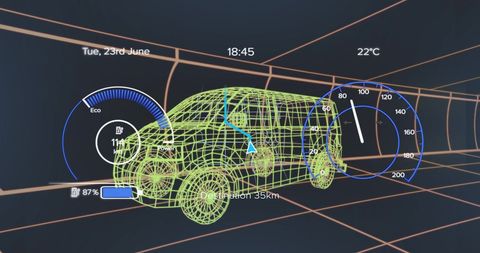
- Visualizing Neon Wireframe Van Projecting Global Data Grid for Geospatial Mapping and AV Simulation
Visualizing Neon Wireframe Van Projecting Global Data Grid for Geospatial Mapping and AV Simulation Image
Featuring neon-green wireframe van projecting purple world map nodes across orange grid. Conveying concepts: autonomous vehicle simulation, fleet tracking, geospatial analytics, digital twin visualization, network connectivity. Working well for website hero banners, pitch decks, whitepapers, product pages, trade show graphics, social media ads. Pairing with bold typography, high-contrast color palettes, layered data overlays for modern tech branding. Enabling cropping for landscape and banner formats, adding motion graphics for video intros, using as hero background for mapping or mobility solutions.
Powered by 


downloads
Tags:
More
Credit Photo
If you would like to credit the Photo, here are some ways you can do so
Text Link
photo Link
<span class="text-link">
<span>
<a target="_blank" href=https://pikwizard.com/photo/visualizing-neon-wireframe-van-projecting-global-data-grid-for-geospatial-mapping-and-av-simulation/7754681ee47ff5e76cb54edd7b362c0c/>PikWizard</a>
</span>
</span>
<span class="image-link">
<span
style="margin: 0 0 20px 0; display: inline-block; vertical-align: middle; width: 100%;"
>
<a
target="_blank"
href="https://pikwizard.com/photo/visualizing-neon-wireframe-van-projecting-global-data-grid-for-geospatial-mapping-and-av-simulation/7754681ee47ff5e76cb54edd7b362c0c/"
style="text-decoration: none; font-size: 10px; margin: 0;"
>
<img src="https://pikwizard.com/pw/medium/7754681ee47ff5e76cb54edd7b362c0c.jpg" style="margin: 0; width: 100%;" alt="" />
<p style="font-size: 12px; margin: 0;">PikWizard</p>
</a>
</span>
</span>
Free (free of charge)
Free for personal and commercial use.
Author: Creative Art