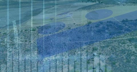
FREE Stock Photos from PikWizardFREE Stock Photos from PikWizard
Videos
Templates
PNGs
Data SetsPhotosVideosTemplatesPNGs
More
  • Most Popular Photos

  • Most Popular Videos

  • Most Popular Templates

  • Most Popular PNGs

  • Upcoming Events

  • Blog

  • Image Editor

  • DesignWizard

  • Privacy Policy

  • Standard License

  • User Agreement

  • Contact

Popular:

  • Bowling Pins
  • Sleeping Cat
  • Winter Night Background
  • Summer Ocean
  • Recreation
  • Cactus Desktop Wallpaper
  • Spa
  • Log Cabin
  • Napa Valley
  • Purple Columbine Flower
  • Stretching
  • Barefoot
  • Static Texture
  • Cobblestone
  • Suits
  • Thinking
  • Trip
  • Zoom Backgrounds Window
  • Concrete Texture
  • Pain HD Wallpapers
  • All Photos

Survey Drone Images

  • drone
  • technology
  • aerial
  • aigenerated
  • hovering
  • quadcopter
  • surveying
  • landscape
  • uav
  • remote
  • horizon
  • camera
  • sky
  • exploration
  • mapping
  • outdoor
  • blue
  • clear
  • gimbal
  • remote sensing
Loading...
 
Lumberjacks operating drone in forest for land survey
lumberjack
drone
forest
 
AI
Drone surveying crop canopy with glowing beacons over rural farmland at golden hour
drone
precision agriculture
crop monitoring
 
AI
Quadcopter drone filming volcanic eruption over caldera with massive ash plume
volcano
ash plume
eruption
Premium
Aerial Rice Terraces Jatiluwih Bali Scene Showing Drone Survey Over Winding Green Paddies, Palm Tree Shadows
aerial
agriculture
bali
 
Drone sharing data over arid terrain with digital graphs overlay
quadcopter
drone
data
Premium
Wind turbine farm engineer, green energy engineering, eco-friendly electricity power technology industry. Technician engineer team working maintenance wind turbine generator with using survey drone.
business
carbon
caucasian
 
Delivery drone hovers at commercial port
delivery drone
shipping
port
 
AI
Futuristic drone hub with neon lighting at dusk
futuristic hub
drones
neon lighting
 
Drone delivery at airport near green airplane
drone delivery
hovering drone
airport
 
Engineer operating drone in field with wind turbine in background
engineer
drone
operation
 
AI
Farmer monitoring crops with drone over field for precision agriculture and crop scouting
drone
precision agriculture
crop monitoring
 
AI
Hovering survey drone scanning polar crevasse with red laser over arctic glacier
drone
survey drone
glacier
 
AI
Drone hovering over vast urban park canopy with modern skyline background
drone
quadcopter
aerial
 
Aerial coast showing hud overlay at low tide with wet flats, waves and snowy headland
coastal
shoreline
aerial
 
Quadcopter drone in field with dynamic red line graph overlay
drone
technology
agriculture
 
AI
Hovering drone over lavender field at golden hour showing gimbal and spinning propellers
drone
lavender field
quadcopter
Premium
Woman operating drone and smiling while wearing orange safety vest on building pier by the seaside; coastal survey joy.
aerial
african
american
 
Aerial drone surveying rugged coastline with hud overlay tracing curving coastal road
aerial
drone
coastline
 
AI
Scientist analyzing 3d geospatial table with drone and heatmap in laboratory control room
drone
geospatial
3d map
Premium
Drone Gps positioning system, Aerial view land plot. Land Surveying for property location, Drone mapping measurement area technology for land construction concept.
aerial
area
block
 
AI
Drone capturing volcanic eruption with massive ash plume over crater
drone
quadcopter
volcanic eruption
 
AI
Hexacopter drone surveying urban ruins with workers monitoring
hexacopter
drone
urban
 
AI
Hovering foldable quadcopter navigating iridescent crystal cavern with light beams
drone
quadcopter
uav
 
AI
Senior scientist analyzing 3d topographic table with drone mapping waypoints and routes
drone mapping
3d topography
terrain model
 
White quadcopter drone hovering over rocky desert field with camera gimbal, cinematic
drone
quadcopter
uav
 
AI
Construction engineer using drone technology at urban site
construction engineer
drone technology
urban development
 
AI
Hovering drone surveying winding canyon river at sunset over red sandstone mesa cliffs
drone
quadcopter
aerial
 
Engineer piloting drone on rocky terrain with telemetry display
engineer
drone piloting
telemetry
 
AI
Hovering gray quadcopter drone in iridescent crystal cavern displaying forward gimbal
drone
quadcopter
gimbal
 
AI
Hovering drone with front camera and blue leds in narrow red canyon over waterfall rainbow
drone
quadcopter
aerial
 
AI
Misty rainforest drone surveying canopy with camera gimbal and glowing rotor lights
drone
quadcopter
aerial
 
AI
Advanced drone conducting inventory check in modern warehouse
warehouse
drone
inventory
Premium
Team of engineers survey drone remotely and inspect high angle view of wind turbine field, win nature, industry and environmental concept, clean energy
building contractor
building exterior
clean
 
AI
Drone hovering over autumn forest with cinematic motion blur and gimbal camera
drone
quadcopter
aerial
Premium
Two engineers in safety gear operate a drone to survey a wind farm, showcasing modern technology in renewable energy maintenance and inspection.
alternative
clothing
communication
Premium
Innovation aerial uav drone copter flying with camera above opencast mining open coal. Concept engineering geology industry.
3d
aerial
banner
 
AI
Hovering drone surveying fog-filled mountain valley at pink dawn over forested ridge
drone
aerial
fog
Premium
Engineer in a safety vest operating a drone to inspect and survey electrical power lines. Technician inspecting the power station for scheduled maintenance.
business
cable
camera
Premium
Illustrating neon green zigzag line graph overlaying farmland, with faint tire tracks, grid labels. Agriculture, data visualization, farmland, precision farming, drone survey, geometric patterns,
aerial
agriculture
bright
 
AI
Drone surveying winding mountain pass road through foggy alpine valley at dusk
drone
aerial
mountain
 
Aerial view rc drone red indicator lights
drone
aerial view
quadcopter
 
AI
Hovering drone filming misty tropical rainforest canopy over mountain valley camera gimbal
drone
aerial
rainforest
 
AI
Drone hovering above serene pastel pink daisy meadow
drone
daisy meadow
pastel pink
 
Drone hovering over greenery for aerial photography and video
drone
aerial
landscape
 
Augmented reality surveying revealing concrete footings in sandy excavation for site planning
augmented reality
ar overlay
excavation
 
AI
Vtol surveillance drone surveying naval fleet with futuristic hud 2026 over sunlit channel
drone
uav
vtol
 
Drone hovering with camera capturing nature scenery
drone
camera
aerial photography
 
AI
Quadcopter hovering over downtown avenue projecting holographic city mapping at dusk
drone
quadcopter
aerial
 
AI
Hiking man operating drone over mountain ridge during golden hour, summit adventure
drone
hiker
mountain
Premium
Compact drone for agricultural monitoring
aerial image
aerial inspection
aerial monitoring
 
AI
Drone hovering over mist-filled canyon at twilight with pastel light
drone
quadcopter
aerial
 
Aerial desert mapping with holographic geospatial orbs hovering over winding dirt trail
aerial
desert
geospatial
 
AI
Standing german shepherd surveying misty mountain valley with distant castle spire
german shepherd
dog
standing
 
Drone surveying coastal farmland capturing patchwork fields and hedgerows with telemetry hud overlay
drone
aerial
farmland
 
AI
Hovering drone surveying frozen lake with glowing cyan ice cracks and misty trees
drone
quadcopter
aerial
 
AI
Drone performing surveillance over post-disaster recovery area
drone
surveillance
disaster recovery
Premium
Drone inspects damage on solar panel in a Rooftop Renewable energy. Engineer surveyor team Use drone for operator inspecting and survey construction site
aerial
aircraft
analysis
 
Galaxy ngc 24 captured by hubble telescope using advanced camera for surveys
ngc 24
spiral galaxy
hubble space telescope
 
Modern drone flying high in blue sky with clouds
drone
flying
clouds
Premium
Drone flying above forest trees under cloudy sky, used for aerial survey, monitoring, and environmental research.
aerial
analysis
autonomous
Premium
A drone flies over a forest, conducting forest inspections. This new technology enhances forest management efficiency by utilizing drones for wood management.
aerial
analytics
applications
 
Uav drone mapping in desert terrain with data overlays
uav
drone
telemetry
 
Construction workers surveying building site with crane and scaffolding
construction
scaffolding
tower crane
Premium
Small agriculture drone on green rice field. Survey mapping land field or spraying crops with herbicide aerial technology.
aerial
aerial photography
aerial survey
 
AI
Walking farmer inspecting crops with drone over green farmland landscape
farmer
drone
crop inspection
 
Survey drone over maritime port with ships and cranes, logistics hub
survey drone
maritime port
shipping container
 
AI
Hovering drone mapping frozen turquoise lake with glowing grid and distant mountains
drone
quadcopter
mapping
 
Close-up view of small drone taking off indoors
drone
technology
take-off
 
Field technician conducting geospatial survey holding tablet with data analytics overlay
geospatial survey
field technician
surveying
Premium
Surveying engineers use cameras and drones to survey road and high-speed railway construction sites or conduct safety inspections.
accuracy
architect
architecture
 
AI
Hovering drone casting shadow over 2023 numerals on polar sea ice horizon
drone
polar
sea ice
Premium
Drone in the air inspecting the roof over the house closeup on blue sky
aerial
air
aircraft
 
Drone imagery analyzing farmland growth and patterns
precision farming
agriculture technology
drone imagery
 
Man operating drone in open landscape while conducting survey
man
drone
remote control
 
AI
Hovering quadcopter capturing aerial survey over narrow rocky ridge during golden hour
drone
quadcopter
aerial survey
 
AI
Drone hovering over autumn forest capturing aerial footage of golden foliage
drone
quadcopter
aerial