
- Home >
- Stock Videos >
- 3D Render of Geospatial Terrain With Hotspots and Yellow Networks
3D Render of Geospatial Terrain With Hotspots and Yellow Networks Video
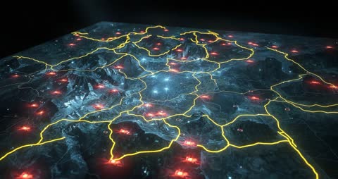
AI Generated Image. Intricate depiction of a geospatial map showcasing detailed terrain with vibrant red hotspots and defined yellow network lines. Perfect for illustrating themes of geospatial technology, digital connectivity, and abstract network systems, this digital creation serves as a valuable asset in presentations or education on digital mapping and artificial intelligence applications.
Powered by 


0
downloads
downloads
Tags:
More
Credit Photo
If you would like to credit the Photo, here are some ways you can do so
Text Link
video Link
<span class="text-link">
<span>
<a target="_blank" href=https://pikwizard.com/video/3d-render-of-geospatial-terrain-with-hotspots-and-yellow-networks/9ce9a909d2836032b2d8186bf18e8ea1/>PikWizard</a>
</span>
</span>
<span class="image-link">
<span
style="margin: 0 0 20px 0; display: inline-block; vertical-align: middle; width: 100%;"
>
<a
target="_blank"
href="https://pikwizard.com/video/3d-render-of-geospatial-terrain-with-hotspots-and-yellow-networks/9ce9a909d2836032b2d8186bf18e8ea1/"
style="text-decoration: none; font-size: 10px; margin: 0;"
>
<video controls style="width: 100%; margin: 0;">
<source src="https://player.vimeo.com/progressive_redirect/playback/1115088158/rendition/240p/file.mp4?loc=external&oauth2_token_id=1223210874&signature=7919c69641c5d41fab996a7569c7a9d0144443da799b91edffb68aa578dbba8a" type="video/mp4"
poster="https://pikwizard.com/pw/medium/9ce9a909d2836032b2d8186bf18e8ea1.jpg"/>
Your browser does not support the video tag.
</video>
<p style="font-size: 12px; margin: 0;">PikWizard</p>
</a>
</span>
</span>
Free (free of charge)
Free for personal and commercial use.
Author: AI Creator