
- Home >
- Stock Videos >
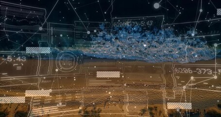
- Aerial Riverbank HUD Monitoring with Radar Sweep, Pulsing Globe and Dynamic Data Chart
Aerial Riverbank HUD Monitoring with Radar Sweep, Pulsing Globe and Dynamic Data Chart Video
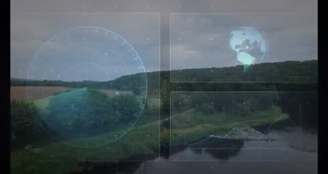
Video showing aerial riverbank with HUD overlay, radar sweeping clockwise, pulsing globe and animated data chart tracking shoreline contours. Footage offering high vantage over river, jetty and tree-lined banks, merging natural landscape with futuristic geospatial visuals. Creative uses including background for tech presentations, news graphics, corporate openers, environmental monitoring reports, coastal surveillance demos and UI concept showcases. Post-production options including overlaying brand elements, adding lower thirds, color grading to match brand palette, isolating HUD layers for mockups and looping for website hero or broadcast background. Target audiences including GIS teams, drone operators, environmental agencies, defense planners, media producers and marketing departments seeking modern data-driven visuals.
Powered by 


0
downloads
downloads
Tags:
More
Credit Photo
If you would like to credit the Photo, here are some ways you can do so
Text Link
video Link
<span class="text-link">
<span>
<a target="_blank" href=https://pikwizard.com/video/aerial-riverbank-hud-monitoring-with-radar-sweep-pulsing-globe-and-dynamic-data-chart/0b4739d0774fc517b35f647b0ebed7b5/>PikWizard</a>
</span>
</span>
<span class="image-link">
<span
style="margin: 0 0 20px 0; display: inline-block; vertical-align: middle; width: 100%;"
>
<a
target="_blank"
href="https://pikwizard.com/video/aerial-riverbank-hud-monitoring-with-radar-sweep-pulsing-globe-and-dynamic-data-chart/0b4739d0774fc517b35f647b0ebed7b5/"
style="text-decoration: none; font-size: 10px; margin: 0;"
>
<video controls style="width: 100%; margin: 0;">
<source src="https://player.vimeo.com/progressive_redirect/playback/1141549055/rendition/240p/file.mp4?loc=external&oauth2_token_id=1223210874&signature=18ff969030e0249f5a223d3fd7d40713b5ed54375b648ffc1f408b6731fab467" type="video/mp4"
poster="https://pikwizard.com/pw/medium/0b4739d0774fc517b35f647b0ebed7b5.jpg"/>
Your browser does not support the video tag.
</video>
<p style="font-size: 12px; margin: 0;">PikWizard</p>
</a>
</span>
</span>
Free (free of charge)
Free for personal and commercial use.
Author: Awesome Content