
- Home >
- Stock Videos >
- Animated Satellite Map Outlining Desert Territory with Contour Lines and Elevation Ridges
Animated Satellite Map Outlining Desert Territory with Contour Lines and Elevation Ridges Video
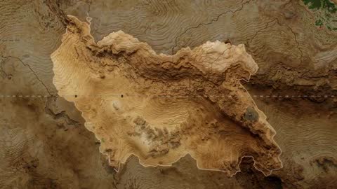
AI Generated Image. Video clip showing animated satellite map outlining desert region with pale boundary and layered contour lines, revealing detailed topography and elevation gradients. Highlighting ridge lines, dune formations, and subtle shading variations to emphasize elevation and relief. Ideal for use in documentary sequences, geography lessons, GIS presentations, environmental impact reports, travel or exploration intros, and news graphics. Working well as background for website hero banners, data-driven explainer videos, corporate slide decks, or social media reels. Allowing easy overlaying of vector routes, markers, animated labels, or statistical heatmaps for storytelling and education. AI-generated style offering stylized color grading and exaggerated contour depth for dramatic visual emphasis.
Powered by 


0
downloads
downloads
Tags:
More
Credit Photo
If you would like to credit the Photo, here are some ways you can do so
Text Link
video Link
<span class="text-link">
<span>
<a target="_blank" href=https://pikwizard.com/video/animated-satellite-map-outlining-desert-territory-with-contour-lines-and-elevation-ridges/084725578e6f6bd85ff09944968440b9/>PikWizard</a>
</span>
</span>
<span class="image-link">
<span
style="margin: 0 0 20px 0; display: inline-block; vertical-align: middle; width: 100%;"
>
<a
target="_blank"
href="https://pikwizard.com/video/animated-satellite-map-outlining-desert-territory-with-contour-lines-and-elevation-ridges/084725578e6f6bd85ff09944968440b9/"
style="text-decoration: none; font-size: 10px; margin: 0;"
>
<video controls style="width: 100%; margin: 0;">
<source src="https://player.vimeo.com/progressive_redirect/playback/1142374786/rendition/240p/file.mp4?loc=external&oauth2_token_id=1223210874&signature=b72053d9c81b2c5985dfd00698928048018b9b24f9dfe0b8d4a321f63be51178" type="video/mp4"
poster="https://pikwizard.com/pw/medium/084725578e6f6bd85ff09944968440b9.jpg"/>
Your browser does not support the video tag.
</video>
<p style="font-size: 12px; margin: 0;">PikWizard</p>
</a>
</span>
</span>
Free (free of charge)
Free for personal and commercial use.
Author: AI Creator