
- Home >
- Stock Videos >
- Drone Capturing Patchwork Farmland Mosaic While Mapping Hedgerows and Field Boundaries
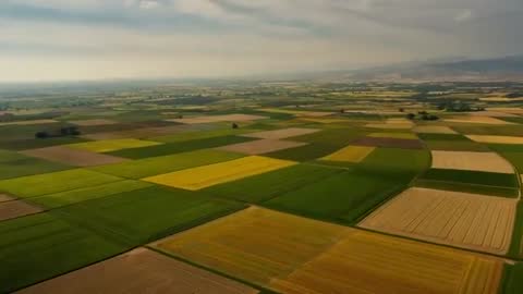
Drone Capturing Patchwork Farmland Mosaic While Mapping Hedgerows and Field Boundaries Video
AI
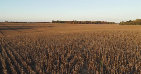
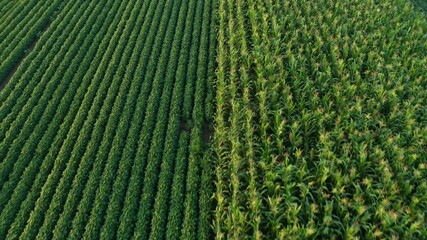
AI Generated Video. Forward-moving drone footage capturing expansive patchwork of crop fields and hedgerow lines from oblique altitude, revealing geometric field grid and distant hills. Soft overcast light casting muted shadows and enhancing green and gold crop bands, creating calm, documentary mood. Footage providing clear view of field boundaries, access tracks, and crop variation for mapping and analysis. Ideal for agricultural marketing, precision farming presentations, GIS mapping demos, environmental planning, and editorial sequences on rural landscape. Useful as hero background for website banners, explainer videos about sustainable farming, investor pitch decks for agritech startups, magazine spreads, or looping backdrop for trade show displays. Technical notes: forward linear tracking with smooth gimbal stabilization, high-resolution capture ready for color grading and stabilization. Color grading suggestions: boost greens for fresh growth and warm highlights to emphasize harvest tones.
Powered by 

downloads
Tags:
More
Credit Photo
If you would like to credit the Photo, here are some ways you can do so
Text Link
video Link
<span class="text-link">
<span>
<a target="_blank" href=https://pikwizard.com/video/drone-capturing-patchwork-farmland-mosaic-while-mapping-hedgerows-and-field-boundaries/7e844c87eb5df96209a2215eeb1a5c8e/>PikWizard</a>
</span>
</span>
<span class="image-link">
<span
style="margin: 0 0 20px 0; display: inline-block; vertical-align: middle; width: 100%;"
>
<a
target="_blank"
href="https://pikwizard.com/video/drone-capturing-patchwork-farmland-mosaic-while-mapping-hedgerows-and-field-boundaries/7e844c87eb5df96209a2215eeb1a5c8e/"
style="text-decoration: none; font-size: 10px; margin: 0;"
>
<video controls style="width: 100%; margin: 0;">
<source src="https://player.vimeo.com/progressive_redirect/playback/1154145143/rendition/240p/file.mp4%20%28240p%29.mp4?loc=external&oauth2_token_id=1223210874&signature=631386ab33876d7261cefc4beb42a216e6564a34b6bfbf87cd67f7278c386523" type="video/mp4"
poster="https://pikwizard.com/pw/medium/7e844c87eb5df96209a2215eeb1a5c8e.jpg"/>
Your browser does not support the video tag.
</video>
<p style="font-size: 12px; margin: 0;">PikWizard</p>
</a>
</span>
</span>
Free (free of charge)
Free for personal and commercial use.
Author: AI Creator