
- Home >
- Stock Videos >
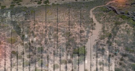
- Drone Over Rocky Desert Fusing Real-Time Data Visualizations
Drone Over Rocky Desert Fusing Real-Time Data Visualizations Video

A drone navigates above a rugged desert terrain while displaying dynamic line charts that integrate real-time analytics. This unique visual representation can be an ideal illustration for projects focusing on remote data collection, technological innovations, and geographic analysis. Perfect for presentations and content related to environmental monitoring, scientific research, and digital transformations in natural settings.
Powered by 


downloads
Tags:
More
Credit Photo
If you would like to credit the Photo, here are some ways you can do so
Text Link
video Link
<span class="text-link">
<span>
<a target="_blank" href=https://pikwizard.com/video/drone-over-rocky-desert-fusing-real-time-data-visualizations/c2324c11975f9c0638686058f0f88d2b/>PikWizard</a>
</span>
</span>
<span class="image-link">
<span
style="margin: 0 0 20px 0; display: inline-block; vertical-align: middle; width: 100%;"
>
<a
target="_blank"
href="https://pikwizard.com/video/drone-over-rocky-desert-fusing-real-time-data-visualizations/c2324c11975f9c0638686058f0f88d2b/"
style="text-decoration: none; font-size: 10px; margin: 0;"
>
<video controls style="width: 100%; margin: 0;">
<source src="https://player.vimeo.com/progressive_redirect/playback/1092626507/rendition/240p/file.mp4?loc=external&oauth2_token_id=1223210874&signature=f65e944a78769101503a63b1c14422223494c3dd677e4596ec760e97cda69ed6" type="video/mp4"
poster="https://pikwizard.com/pw/medium/c2324c11975f9c0638686058f0f88d2b.jpg"/>
Your browser does not support the video tag.
</video>
<p style="font-size: 12px; margin: 0;">PikWizard</p>
</a>
</span>
</span>
Free (free of charge)
Free for personal and commercial use.
Author: Awesome Content