
- Home >
- Stock Videos >
- Opening map overlay showing coastal port ship routes, cargo traffic and drifting clouds
Opening map overlay showing coastal port ship routes, cargo traffic and drifting clouds Video
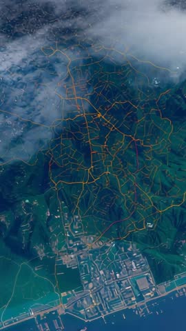
AI Generated Image. Vertical video opening showing coastal port with color-coded ship routes, container terminal and drifting cloud cover. Animated overlay highlighting cargo ship movement, shipping lanes, vessel tracking and port infrastructure against aerial landscape. Ideal for maritime logistics presentations, navigation system demos, supply chain explainers, port operations briefings, weather and traffic news, corporate transport promos and social media reels. Use as intro for documentary, trade show display, client pitch, training module or mobile vertical ad requiring dynamic map visualization. Color palette and animated lines providing clear visual hierarchy for highlighting congestion, route planning and vessel scheduling.
Powered by  - Get 15% off with code: PIKWIZARD15


0
downloads
downloads
Tags:
More
Credit Photo
If you would like to credit the Photo, here are some ways you can do so
Text Link
video Link
<span class="text-link">
<span>
<a target="_blank" href=https://pikwizard.com/video/opening-map-overlay-showing-coastal-port-ship-routes-cargo-traffic-and-drifting-clouds/2db00df97f9ce369749af8c45e2333d6/>PikWizard</a>
</span>
</span>
<span class="image-link">
<span
style="margin: 0 0 20px 0; display: inline-block; vertical-align: middle; width: 100%;"
>
<a
target="_blank"
href="https://pikwizard.com/video/opening-map-overlay-showing-coastal-port-ship-routes-cargo-traffic-and-drifting-clouds/2db00df97f9ce369749af8c45e2333d6/"
style="text-decoration: none; font-size: 10px; margin: 0;"
>
<video controls style="width: 100%; margin: 0;">
<source src="" type="video/mp4"
poster="https://pikwizard.com/pw/medium/2db00df97f9ce369749af8c45e2333d6.jpg"/>
Your browser does not support the video tag.
</video>
<p style="font-size: 12px; margin: 0;">PikWizard</p>
</a>
</span>
</span>
Free (free of charge)
Free for personal and commercial use.
Author: AI Creator