
- Home >
- Free Stock Videos >
- Real-time Urban Sensor Data Visualizing Teal Waveform Over Hazy Skyline Aerial Flow
Real-time Urban Sensor Data Visualizing Teal Waveform Over Hazy Skyline Aerial Flow Free Stock Video
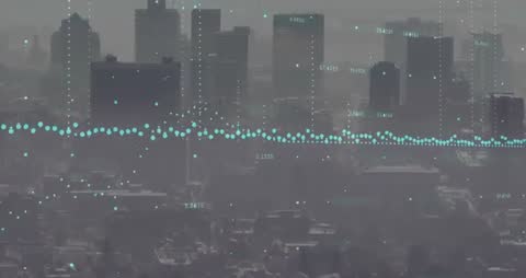
Visualizing urban sensor network data over hazy skyline, teal nodes forming continuous horizontal waveform and vertical data columns. Combining aerial city silhouette with minimal digital overlay, suggesting live telemetry, environmental metrics, traffic flow, and IoT analytics. Suiting technology presentations, smart city reports, corporate websites, broadcast graphics, and analytics dashboards. Allowing designers to overlay custom text, charts, or logos while maintaining modern, data-driven aesthetic. Offering high-contrast teal palette for clean print, web hero banners, social media posts, animated background loops, and explainer video sequences.
Powered by  - Get 15% off with code: PIKWIZARD15


downloads
Tags:
More
Credit Photo
If you would like to credit the Photo, here are some ways you can do so
Text Link
video Link
<span class="text-link">
<span>
<a target="_blank" href=https://pikwizard.com/video/real-time-urban-sensor-data-visualizing-teal-waveform-over-hazy-skyline-aerial-flow/081ad7f324e165a02b425c2bd4fa7934/>PikWizard</a>
</span>
</span>
<span class="image-link">
<span
style="margin: 0 0 20px 0; display: inline-block; vertical-align: middle; width: 100%;"
>
<a
target="_blank"
href="https://pikwizard.com/video/real-time-urban-sensor-data-visualizing-teal-waveform-over-hazy-skyline-aerial-flow/081ad7f324e165a02b425c2bd4fa7934/"
style="text-decoration: none; font-size: 10px; margin: 0;"
>
<video controls style="width: 100%; margin: 0;">
<source src="https://player.vimeo.com/progressive_redirect/playback/1141465078/rendition/240p/file.mp4?loc=external&oauth2_token_id=1223210874&signature=8307ace1921f482d8f97dd125baff830d7615f62c7901e72a4dcbbe8140c7c89" type="video/mp4"
poster="https://thumbs.wbm.im/pw/medium/081ad7f324e165a02b425c2bd4fa7934.jpg"/>
Your browser does not support the video tag.
</video>
<p style="font-size: 12px; margin: 0;">PikWizard</p>
</a>
</span>
</span>
Free (free of charge)
Free for personal and commercial use.
Author: Awesome Content