
- Home >
- Free Stock Videos >
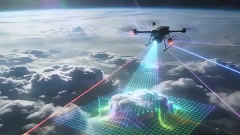
- High-altitude drone scanning cloud deck and mapping 3D grid for atmospheric survey
High-altitude drone scanning cloud deck and mapping 3D grid for atmospheric survey Free Stock Video
AI
AI Generated Video. Video showing high-altitude multirotor drone projecting blue scan beam and colored laser lines while generating holographic 3D grid over cloud deck. Scene presenting advanced aerial mapping and remote sensing workflow, combining LiDAR-style scanning and real-time data visualization. Cinematic wide-angle composition emphasizing scale of atmosphere and horizon, with dramatic cloud layers and neon scan effects. Suitable for technology commercial, weather research presentation, environmental monitoring report, sci-fi trailer, defense simulation, UAV product demo, or educational content about remote sensing. Edit-friendly framing allowing overlay of text, infographics, or UI elements for broadcast, website hero, or social media campaign. Colorful laser beams and grid supporting storytelling about autonomous systems, mapping accuracy, elevation modeling, and future mobility.
Powered by  - Get 15% off with code: PIKWIZARD15


downloads
Tags:
More
Credit Photo
If you would like to credit the Photo, here are some ways you can do so
Text Link
video Link
<span class="text-link">
<span>
<a target="_blank" href=https://pikwizard.com/video/high-altitude-drone-scanning-cloud-deck-and-mapping-3d-grid-for-atmospheric-survey/683c5eca1eee7c529d20cc31ccc9577d/>PikWizard</a>
</span>
</span>
<span class="image-link">
<span
style="margin: 0 0 20px 0; display: inline-block; vertical-align: middle; width: 100%;"
>
<a
target="_blank"
href="https://pikwizard.com/video/high-altitude-drone-scanning-cloud-deck-and-mapping-3d-grid-for-atmospheric-survey/683c5eca1eee7c529d20cc31ccc9577d/"
style="text-decoration: none; font-size: 10px; margin: 0;"
>
<video controls style="width: 100%; margin: 0;">
<source src="https://player.vimeo.com/progressive_redirect/playback/1183800228/rendition/240p/file.mp4%20%28240p%29.mp4?loc=external&oauth2_token_id=1223210874&signature=a0a0f1882b52a7c9114b45c48aab25aac3c5a278f5cab77313741bd0c5d77618" type="video/mp4"
poster="https://thumbs.wbm.im/pw/medium/683c5eca1eee7c529d20cc31ccc9577d.jpg"/>
Your browser does not support the video tag.
</video>
<p style="font-size: 12px; margin: 0;">PikWizard</p>
</a>
</span>
</span>
Free (free of charge)
Free for personal and commercial use.
Author: AI Creator